Weather Hazards for Drone Pilots
Part 107’s weather minimums are three numbers — 3 statute miles visibility, 500 feet below clouds, 2,000 feet horizontally (14 CFR §107.51(c)–(d)) — and they apply in every airspace, Class G included. Everything else in this lesson is about the hazards that arrive without warning when conditions were legal at launch: microbursts under virga, fog closing the spread at dusk, ice loading a propeller in seconds. Recognize the signature, and the right call is usually obvious.
The Hazards That Ground Drones
Weather causes more drone flight cancellations than anything else. The FAA tests your ability to spot hazardous conditions and make the right call — this lesson’s content maps to ACS III.B.K1e–k and II.B.K1.
Thunderstorms
Thunderstorm cell formation needs three ingredients (FAA-H-8083-28, ch. 22): sufficient water vapor, unstable air, and a lifting mechanism. Fronts, terrain, and solar heating all supply the lift.
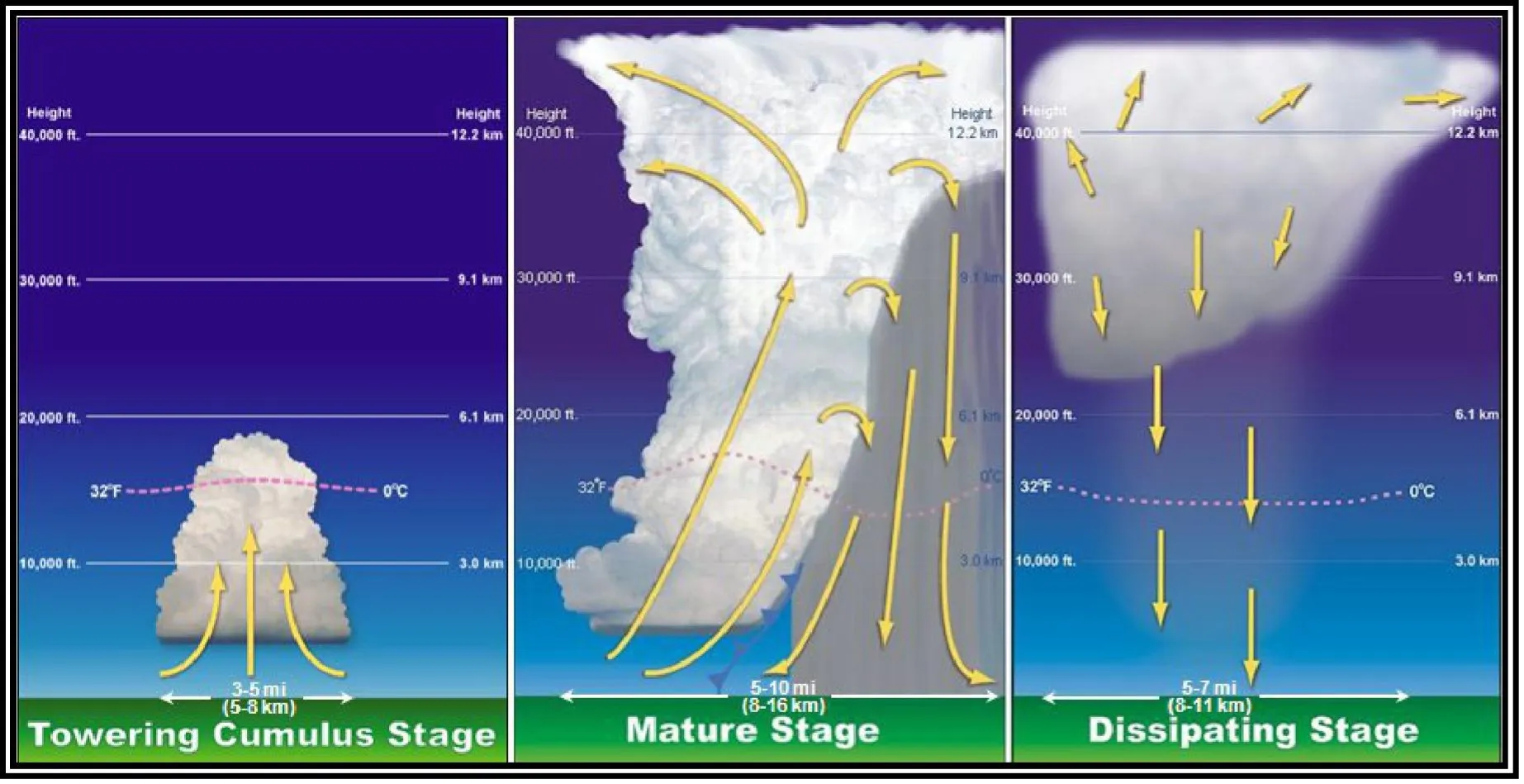
Thunderstorm Life Cycle
- Cumulus stage: updrafts build the cloud; no precipitation yet
- Mature stage: updrafts and downdrafts coexist; heavy rain, lightning, strongest winds — the most dangerous stage
- Dissipating stage: downdrafts dominate; the storm weakens
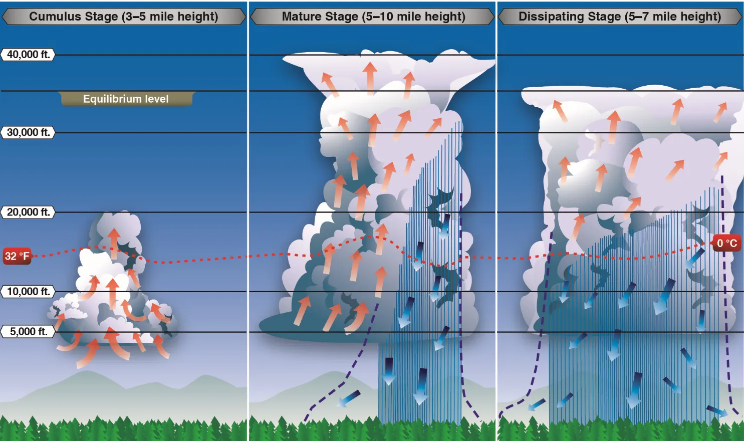
Never fly near a thunderstorm. Downdrafts, turbulence, and lightning can destroy your drone and endanger people on the ground. The FAA considers flight near thunderstorms careless and reckless — and storms 20 miles away can still reach you.
Wind Shear and Microbursts
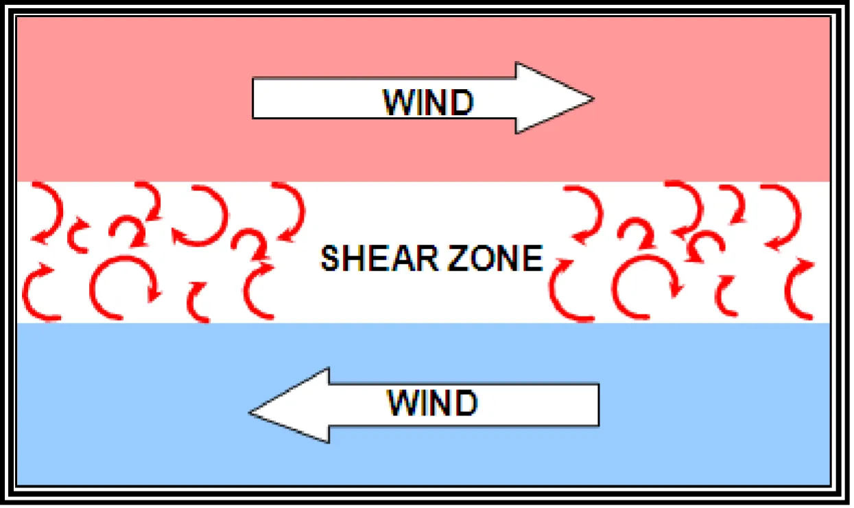
Wind shear: a sudden change in wind speed or direction over a short distance.
Microburst: a small, intense downdraft that spreads outward violently when it hits the ground — “the most severe type of wind shear” (FAA-H-8083-28, ch. 22). The verified numbers:
- Horizontal diameter less than 2.5 miles, about 1,000 ft deep
- Lifespan 5 to 15 minutes
- Downdrafts up to 6,000 feet per minute, with wind shifts and speed losses of 30 to 90 knots
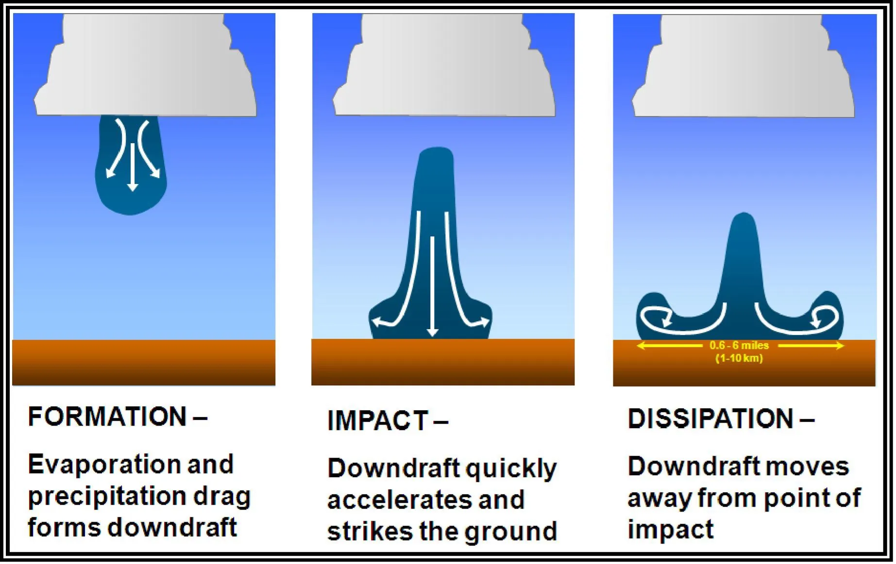
The visible clue problem: a microburst may show an intense rain shaft — but with a dry microburst, virga (precipitation falling from the cloud that evaporates before reaching the ground) and a ring of blowing dust can be the only warning. If the wind changes suddenly and dramatically, land immediately.
Turbulence
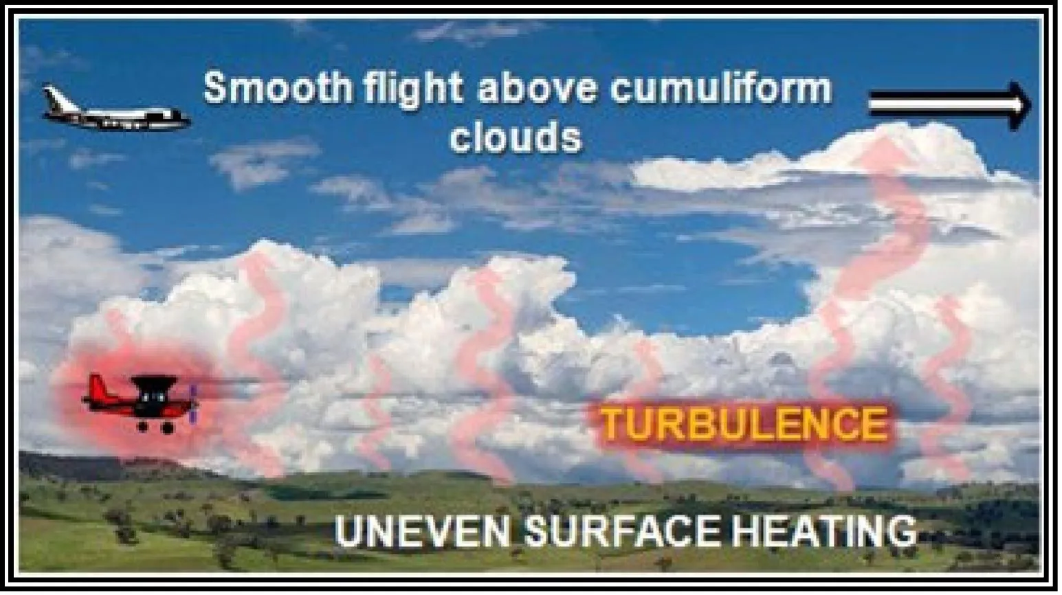
Types that affect drone operations:
- Convective turbulence: heated air rising as thermals; common on hot afternoons
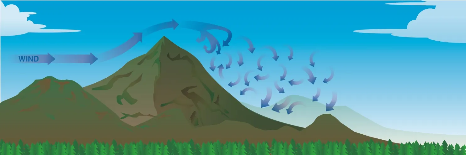
- Mechanical turbulence: wind flowing over buildings, trees, and terrain; eddies and rotors on the downwind side
- Frontal turbulence: along boundaries where air masses meet
- Mountain wave and rotors: strong winds crossing ridges set up waves and violent rotor zones for many miles downwind
Fog
Fog is a cloud at ground level, and it kills your visibility minimum faster than anything else. Lesson 14’s spread logic predicts it: when the evening temperature slides toward the dewpoint, fog follows.
Types of Fog
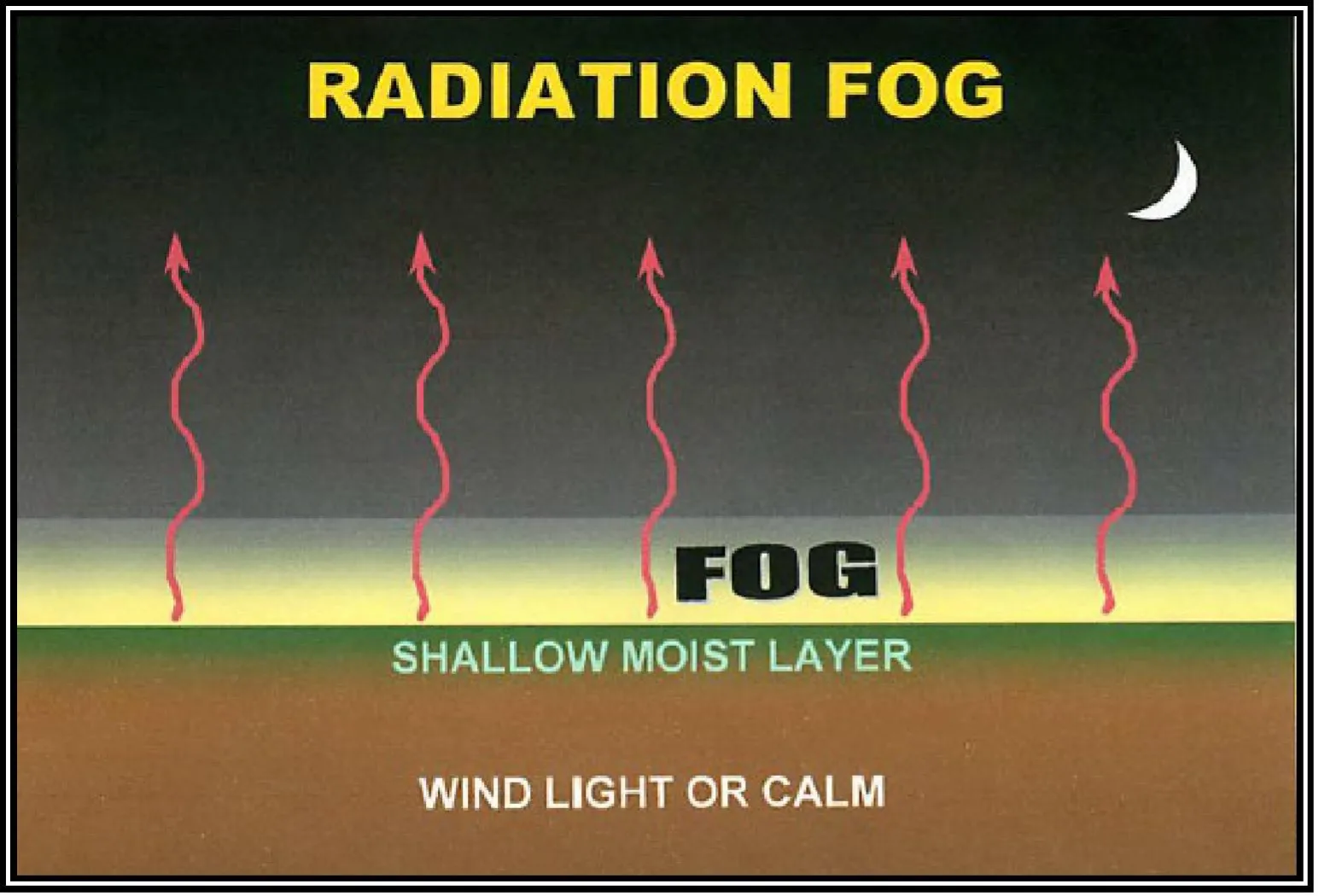
Radiation fog: clear, calm nights; ground heat radiates to space; common in valleys; burns off after sunrise.
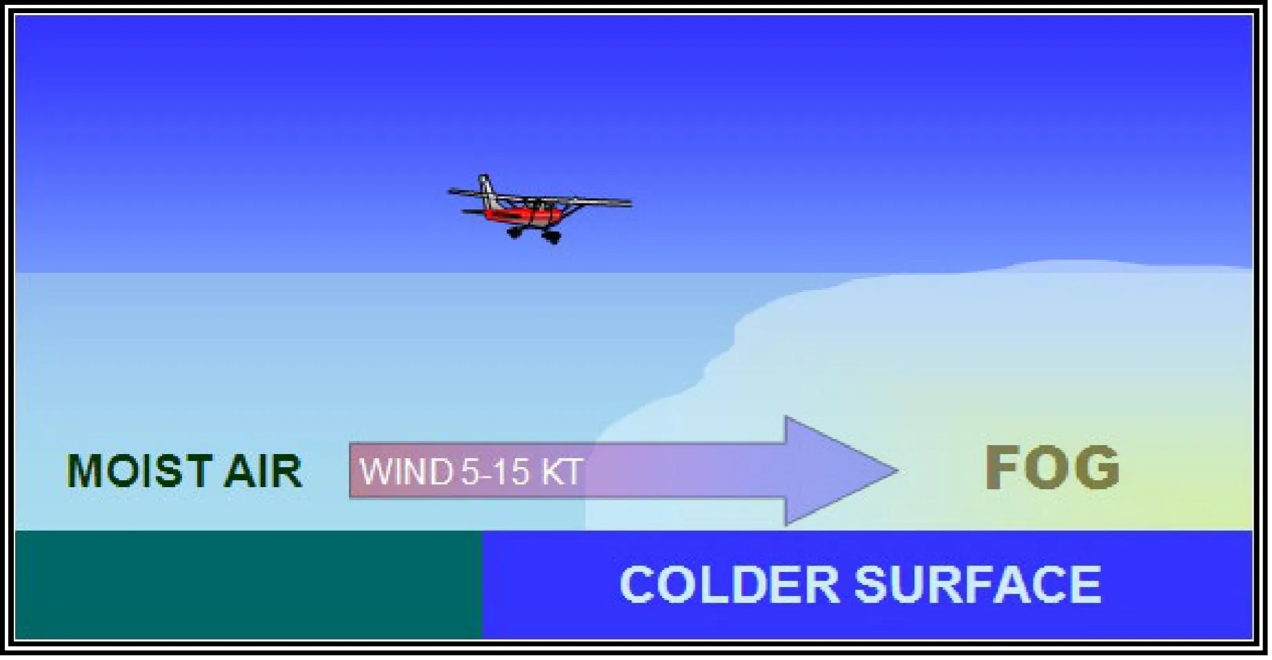
Advection fog: moist air moves over a cooler surface (air over cold water); common along coastlines.
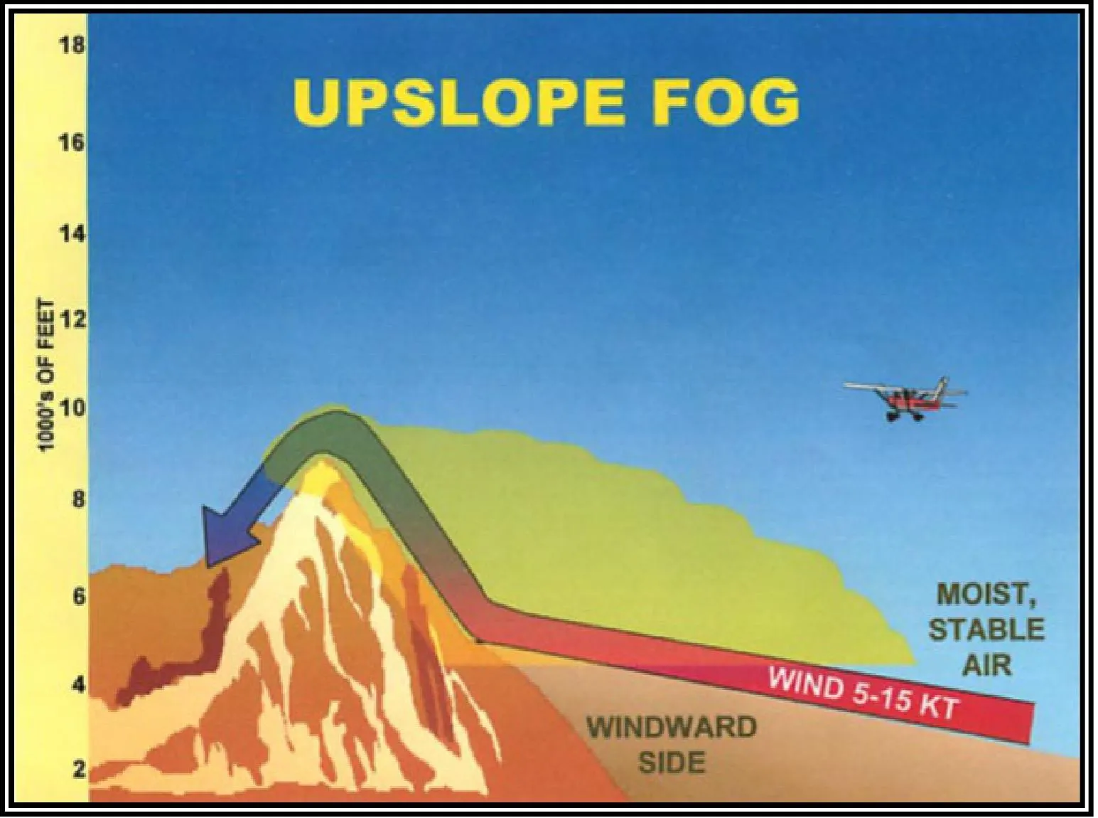
Upslope fog: wind pushes moist air up a slope; mountain country.
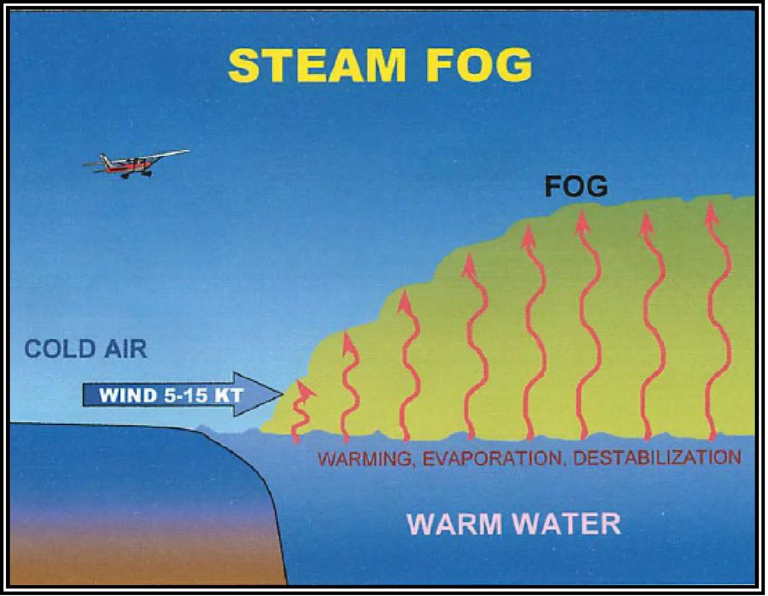
Steam fog: cold air over warm water; looks like rising steam.
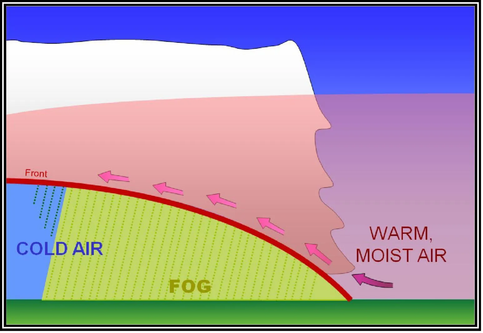
Frontal fog: rain falling through cold air ahead of a warm front; visibility drops along the entire front.
Icing
Structural icing “occurs when supercooled water droplets strike the airframe and freeze” (FAA-H-8083-28, ch. 20) — visible moisture plus freezing temperatures, which drones meet in cloud, drizzle, or rain between 0 °C and about −20 °C:
- Rime ice: small supercooled droplets freezing instantly — rough, milky, opaque; the most frequently reported type
- Clear (glaze) ice: large droplets freezing slowly — smooth, glossy, heavy, the most dangerous
- Mixed ice: both at once
Your drone has no de-icing or anti-icing systems. Any ice accumulation on props or airframe destroys the carefully balanced aerodynamics — an iced propeller can shed or stall without warning. If you encounter icing conditions, land immediately. (A cold battery is its own penalty: expect reduced capacity well before ice ever forms.)
Temperature Inversions
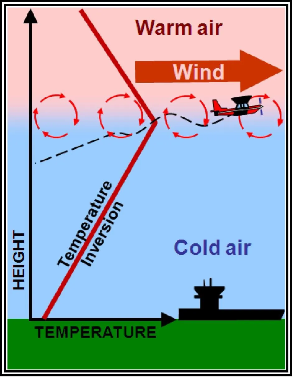
Normally temperature decreases with altitude. An inversion reverses it: within the layer, temperature increases with height.
Effects:
- Traps pollutants, haze, and fog near the surface (poor visibility)
- Often creates glassy-smooth air below the inversion — the calm is real, and so is the visibility reduction
- Suppresses vertical mixing, so haze and smoke persist
Weather Hazards at Night
Night concentrates three hazards (the ACS pairs II.B.K6/K8–K10 with weather awareness):
- Fog formation at dusk — evening cooling closes the temperature-dewpoint spread, and radiation fog forms over exactly the valleys you flew all afternoon
- Reduced visual references — haze and low stratus that were cosmetic by day can eliminate horizon and obstacle cues after dark, while your own visibility minimum (3 SM) is judged from the control station by identifying lighted objects at night
- Lighting illusions — city lights through haze flatten depth perception; a lit tower looks closer or farther than it is
Preflight for a night flight doubles down on the METAR temp/dewpoint spread and the cloud base, because the margin between “legal and fine” and “illegal and disorienting” is thinner after sunset.
Visibility and Cloud Clearance Minimums
The operating rules, cited. Memorize these:
| Condition | Minimum | Rule |
|---|---|---|
| Flight visibility (from the control station) | 3 statute miles | 14 CFR §107.51(c) |
| Distance below clouds | 500 feet | 14 CFR §107.51(d)(1) |
| Distance from clouds horizontally | 2,000 feet | 14 CFR §107.51(d)(2) |
These minimums apply in all airspace — Class G included. Manned pilots get relaxed day minimums in Class G under Part 91 (down to 1 SM and clear of clouds near the surface); drone pilots do not. §107.51 has no airspace carve-outs, and flight visibility is specifically measured from where you’re standing, not where the aircraft is. If visibility at the control station is under 3 SM, the flight is off, waiver or not.
“3-500-2000.” Three miles, 500 below, 2,000 horizontal. If conditions are worse, don’t fly — and note that §107.51’s operating limits are technically waivable under §107.205, but visibility waivers are not routine exam or real-world fare.
Key Facts to Walk In With
ACS references: III.B.K1e–k, II.B.K1
- Thunderstorm ingredients: moisture + instability + lift
- Microburst: under 2.5 mi across, 5–15 min, 6,000 fpm downdrafts, 30–90 kt wind shifts; virga/dust ring as clues
- Icing: supercooled droplets; rime (small drops, milky) vs clear (large drops, heavy) vs mixed
- Fog types: radiation, advection, upslope, steam, frontal
- 3 SM / 500 below / 2,000 horizontal — §107.51(c)–(d), all airspace including Class G
- Night: fog at dusk, lighted-object visibility judgment, lighting illusions
Quick Check
Q: What are the three ingredients for thunderstorm formation? A: Sufficient moisture, unstable air, and a lifting mechanism.
Q: What is a microburst? A: An intense downdraft under 2.5 miles across lasting 5–15 minutes, producing downdrafts up to 6,000 fpm and wind shifts of 30–90 knots.
Q: What are the Part 107 weather minimums? A: 3 SM visibility from the control station, 500 ft below clouds, 2,000 ft horizontally — §107.51(c)–(d).
Q: Do Part 107 weather minimums relax in Class G airspace? A: No. Unlike manned Part 91 VFR rules, §107.51’s minimums apply everywhere.
Q: What conditions produce structural icing? A: Supercooled visible moisture striking an airframe at freezing temperatures — rime from small droplets, clear from large ones.
What’s Next?
Now let’s learn to decode the weather reports that tell you what conditions to expect: METARs and TAFs.
This free course covers the essential knowledge, but if you want video walkthroughs, practice exams, and instructor support, Pilot Institute’s Part 107 course is the most comprehensive option available.