Coordinates, Terrain & Magnetic Variation
Three skills live in this lesson: finding a point from coordinates, reading the ground underneath it, and converting between true and magnetic directions. The FAA hands you coordinates or a compass heading and watches you count tick marks or apply variation. Both are pure procedure — one worked drill each and you own them.
Reading GPS Coordinates
The FAA will give you coordinates and ask you to find a point on the chart, or show a point and ask for coordinates.
The Grid System

- Latitude: lines running east-west, measured north-south from the equator (0° to 90°)
- Longitude: lines running north-south, measured east-west from the Prime Meridian (0° to 180°)
- Grid lines on sectionals are drawn at 30-minute (half-degree) intervals
- Tick marks at 1-minute intervals along the chart edges and mid-chart graticule
Key conversions:
- 1 degree = 60 minutes
- 1 minute of latitude = 1 nautical mile (constant everywhere)
- 1 degree of latitude = 60 nautical miles
- 1 minute of longitude shrinks as you move away from the equator — only latitude minutes are a dependable ruler
Decimal Coordinates: The ×60 Drill
Exam questions and GPS displays use decimal degrees; the chart is marked in degrees and minutes. Convert by multiplying the decimal fraction by 60:
- 46.9°N → 0.9 × 60 = 54 → 46°54’N
- 96.8°W → 0.8 × 60 = 48 → 96°48’W
Going the other way, divide: 27’ ÷ 60 = 0.45 → 33°27’N = 33.45°N.
Finding a Point on the Chart
- Latitude first: find the horizontal band (count 30-minute graticule lines north from the labeled parallel)
- Longitude second: find the vertical band
- Inside the right quadrangle, use the 1-minute tick marks to walk to the exact minute
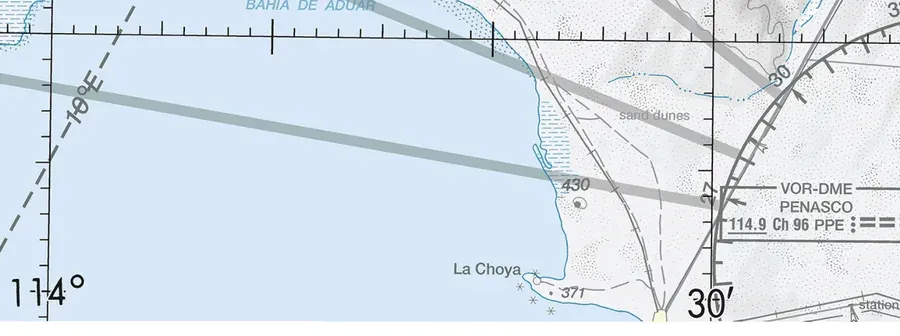 The counting system: 30-minute graticule lines for the band, 1-minute ticks for the walk. Each latitude tick is one nautical mile.
Worked drill: find N 40°15’ / W 104°50’. Latitude first: 40°15’ sits halfway up the band between the 40°00’ and 40°30’ graticule lines — walk 15 one-minute ticks up from 40°00’. Longitude second: from the 105°00’ meridian, walk 10 one-minute ticks east, because 104°50’ lies 10 minutes east of 105°00’. The intersection is your point — and every latitude minute you walked equals 1 NM, so you always know how far you moved.
When the FAA gives you coordinates like “46.9°N, 96.8°W”, convert to minutes FIRST, then find the latitude band, then the longitude band. Trying to eyeball decimal degrees directly on a minute-marked chart is how wrong answers happen.
Three Drills to Run Tonight
- The decimal trap. N 38.75° → 0.75 × 60 = 45 → 38°45’N. (Watch the 0.5 boundary: 38.50° = 38°30’, exactly halfway.)
- The east-or-west test. W 77°12’ vs W 77°48’: both sit inside the 77°–78° band, but on opposite sides of the 77°30’ half-degree graticule. Count which side — crossing a 30-minute line by mistake is the most common coordinate error.
- The distance read. Two points on the same meridian, N 41°10’ and N 41°25’: 15 minutes apart = 15 NM, no ruler needed. Same latitude difference at different longitudes? You need the scale bar, because longitude minutes aren’t constant.
MSL vs AGL — The Critical Distinction
- MSL (Mean Sea Level): altitude measured from average sea level. Used in airspace definitions, altimeter readings, and charted numbers.
- AGL (Above Ground Level): height above the ground directly below your drone.
Your 400-foot Part 107 limit is AGL. Airspace boundaries on charts are MSL. The conversion is one subtraction — Lesson 9 drills it in depth, and it’s the same math here:
Ground elevation is 2,000 ft MSL. You fly at 400 ft AGL, so your drone is at 2,400 ft MSL. A Class D floor at 2,500 ft MSL means you’re 100 ft below it. Legal.
Topographic Colors
The chart’s background tint bands elevation roughly like this:
| Color | Approximate elevation |
|---|---|
| Green | Near sea level (0–1,000 ft) |
| Light yellow/green | 1,000–2,000 ft |
| Yellow/brown | 2,000–5,000 ft |
| Brown | 5,000–8,000 ft |
| Dark brown/maroon | 8,000+ ft |
| Blue | Water features |
Flying in a green area (low elevation)? Your 400 ft AGL is roughly the same as 400 ft MSL. In the brown mountains, ground at 5,000 ft MSL means your 400 ft AGL flight is at 5,400 ft MSL — which can put you inside airspace floors that a flatland pilot would never think about.
Spot Elevations, Contours, and Peaks
- Spot elevations: dots with MSL numbers marking specific high and low points
- Contour lines: brown lines of constant elevation; the closer together, the steeper the terrain
- Peak markers: summit symbols with the MSL elevation beside them
For drone work, contour spacing is a turbulence and line-of-sight clue: tightly packed lines above your launch site mean terrain that can block both your visual line of sight and your control link faster than the map distance suggests.
Magnetic Variation

True north (the geographic pole on the chart’s graticule) and magnetic north (where your compass points) are different points, and the angle between them at your location is magnetic variation. On sectionals, isogonic lines — dashed magenta lines with labels like 14°W or 12°E — connect points of equal variation.
Why it matters to you: runway numbers, airway courses, and wind directions issued by towers are all magnetic. The chart’s lat/long graticule is true. Any time the exam bridges those two worlds, you apply variation.
The Conversion, Both Directions
| You have | You want | East variation | West variation |
|---|---|---|---|
| True | Magnetic | subtract E | add W |
| Magnetic | True | add E | subtract W |
“East is least, west is best” works converting true to magnetic. Run it in reverse when you’re going magnetic to true.
Worked example 1 — true to magnetic. Your course measured off the chart (true) is 090°. Local variation is 14°W. Magnetic course = 090 + 14 = 104°.
Worked example 2 — magnetic to true. Runway 27 points along magnetic heading 270. Variation here is 12°E. True heading of the runway centerline = 270 + 12 = 282°.
Worked example 3 — west variation, reverse direction. A tower reports wind at 220° (magnetic, like all tower winds). Variation is 9°W. True wind direction = 220 − 9 = 211°.
Read the direction of the conversion before you touch the numbers. Two identities cover every version of the question: True = Magnetic + East = Magnetic − West, and Magnetic = True + West = True − East. Write them down, substitute, and the sign takes care of itself.
Where Runway Numbers Come From
Runway numbers aren’t decorative: “the runway number is the whole number nearest one-tenth the magnetic azimuth of the centerline of the runway” (AIM ¶2-3-3). Magnetic azimuth 183° → runway 18. Azimuth 87° → runway 9. That’s why runway numbers and variation change together over the years as magnetic north drifts — and why a runway can be renumbered without moving an inch of pavement.
Why a GPS Drone Pilot Cares About Variation
Your drone navigates by satellite, so when does true-vs-magnetic matter outside the test center? Three places:
- Reading the aviation world around you — runway numbers, tower-issued winds, and airway courses are magnetic. When a tower tells you “wind 220 at 15” and you’re judging your crosswind for a launch near the pattern, you’re doing variation math whether you meant to or not.
- Compass fallbacks — every drone carries a magnetometer for attitude and failsafe heading. Return-to-home legs and course holds run on magnetic sensing; big local variation left uncalibrated is one more source of drift.
- The exam — II.A chart questions convert between true and magnetic as a matter of course. The identities above are full-credit answers waiting to happen.
Key Facts to Walk In With
ACS reference: II.A.K1 (applied chart skills)
- 1 minute of latitude = 1 NM; grid lines every 30 minutes; ticks every 1 minute
- Decimal ↔ minutes: multiply or divide by 60
- True = Magnetic + East = Magnetic − West
- Runway number = magnetic azimuth ÷ 10, rounded to the whole number
- Tower-issued wind direction is magnetic, in knots
- Contour spacing = steepness; background tint bands elevation
Quick Check
Q: How many nautical miles is 1 minute of latitude? A: 1 nautical mile.
Q: Your ground elevation is 3,000 ft MSL. You fly at 400 ft AGL. What is your MSL altitude? A: 3,400 ft MSL.
Q: Convert 41.25°N to degrees and minutes. A: 0.25 × 60 = 15 → 41°15’N.
Q: True course 180°, variation 10°W. Magnetic course? A: 190° — west variation adds going true to magnetic.
Q: A runway’s magnetic azimuth is 87°. What’s its runway number? A: Runway 9.
What’s Next?
Now let’s put it all together with a step-by-step chart reading walkthrough, exactly like you’ll see on the exam.
This free course covers the essential knowledge, but if you want video walkthroughs, practice exams, and instructor support, Pilot Institute’s Part 107 course is the most comprehensive option available.