Weather Hazards for Drone Pilots
The Hazards That Ground Drones
Weather causes more drone flight cancellations than anything else. The FAA tests your ability to spot hazardous conditions and make the right call.
Thunderstorms
Three ingredients create thunderstorms:
- Moisture (water vapor)
- Instability (air that wants to rise)
- Lifting mechanism (front, terrain, heating)
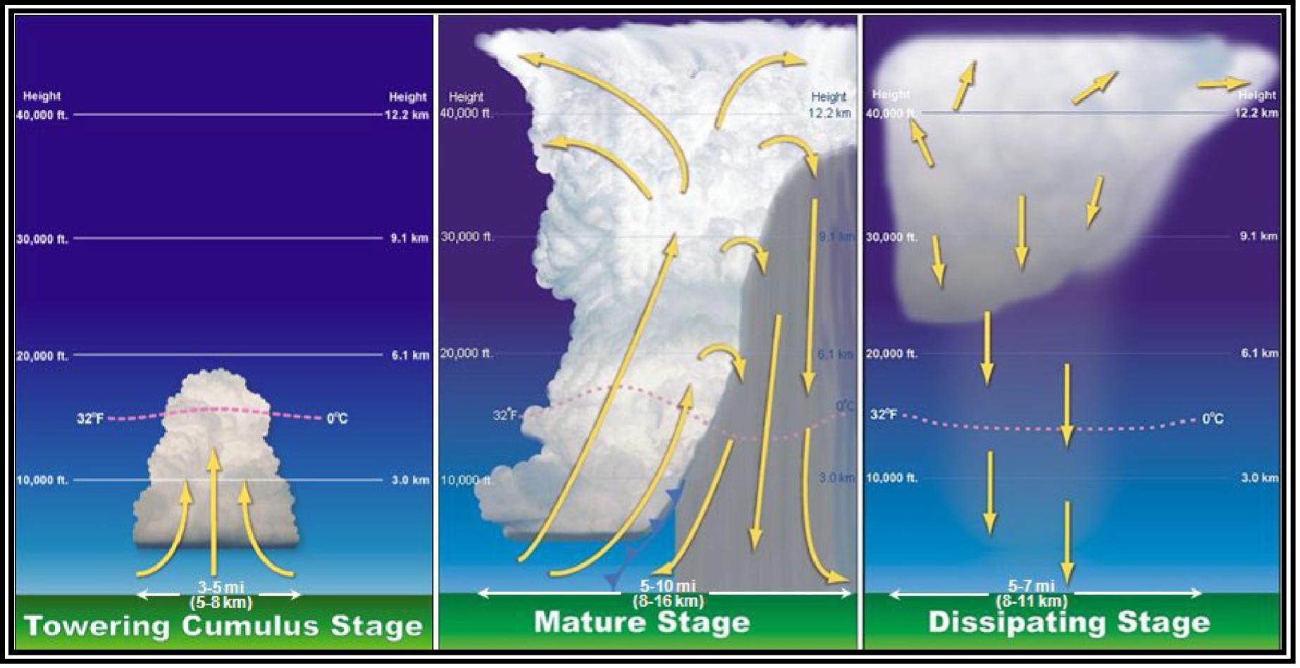
Thunderstorm Life Cycle
- Cumulus stage: Updrafts build the cloud. No precipitation yet.
- Mature stage: Both updrafts and downdrafts. Heavy rain, lightning, strongest winds. Most dangerous.
- Dissipating stage: Downdrafts dominate. Storm weakens.
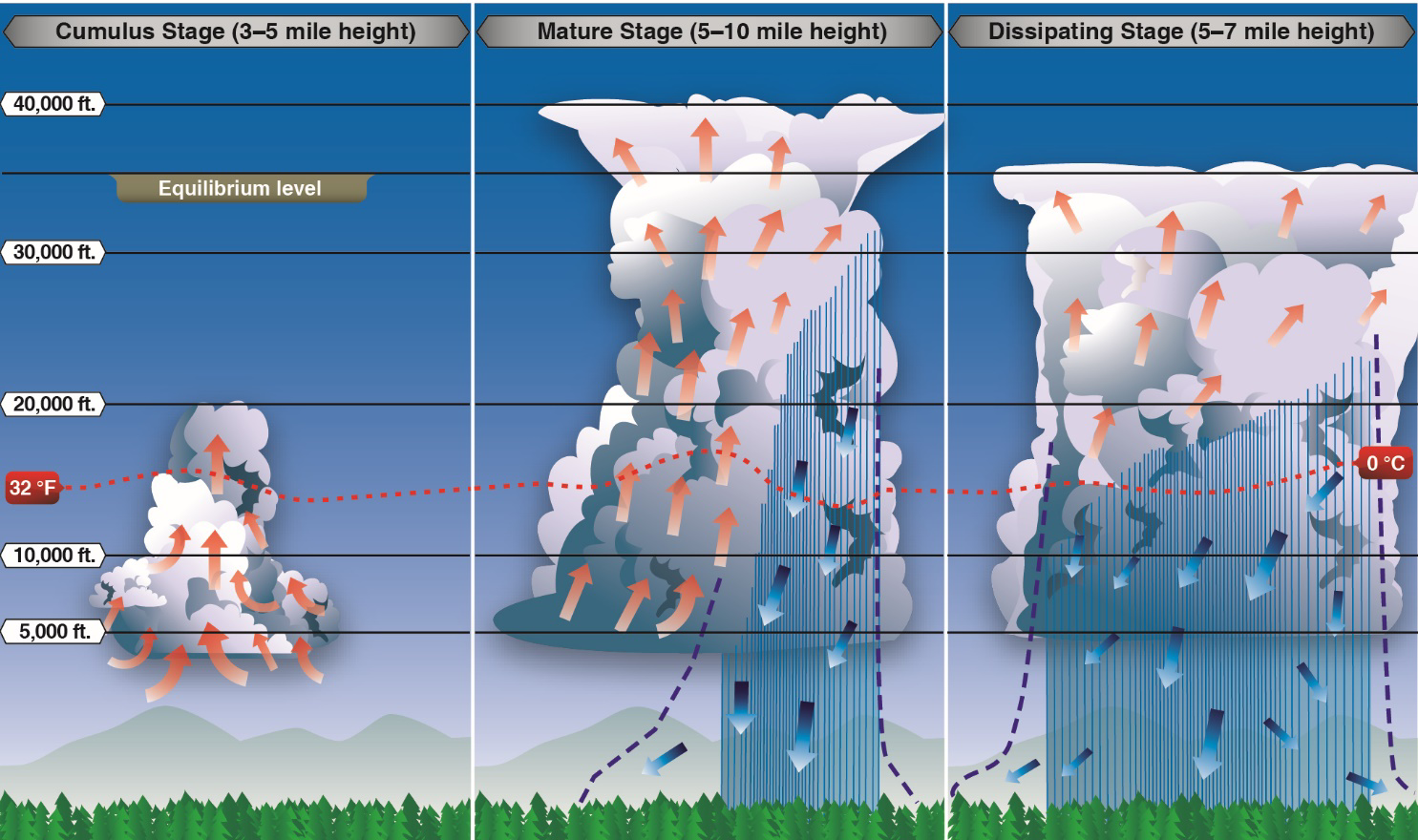
Never fly near a thunderstorm. Downdrafts, turbulence, and lightning can be fatal to your drone and dangerous to people on the ground. The FAA considers flying near thunderstorms careless and reckless.
Wind Shear and Microbursts
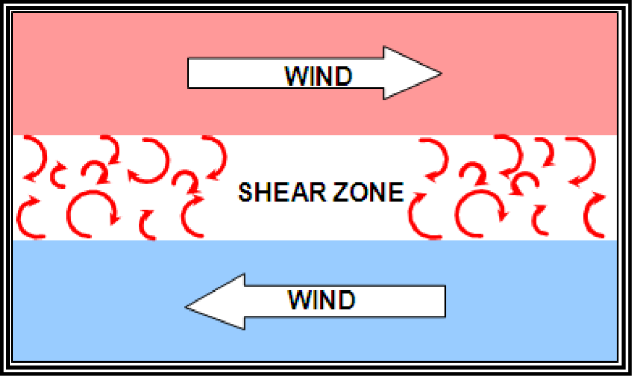
Wind shear: A sudden change in wind speed or direction over a short distance.
Microburst: A concentrated, powerful downdraft (less than 2.5 miles across) that hits the ground and spreads outward.
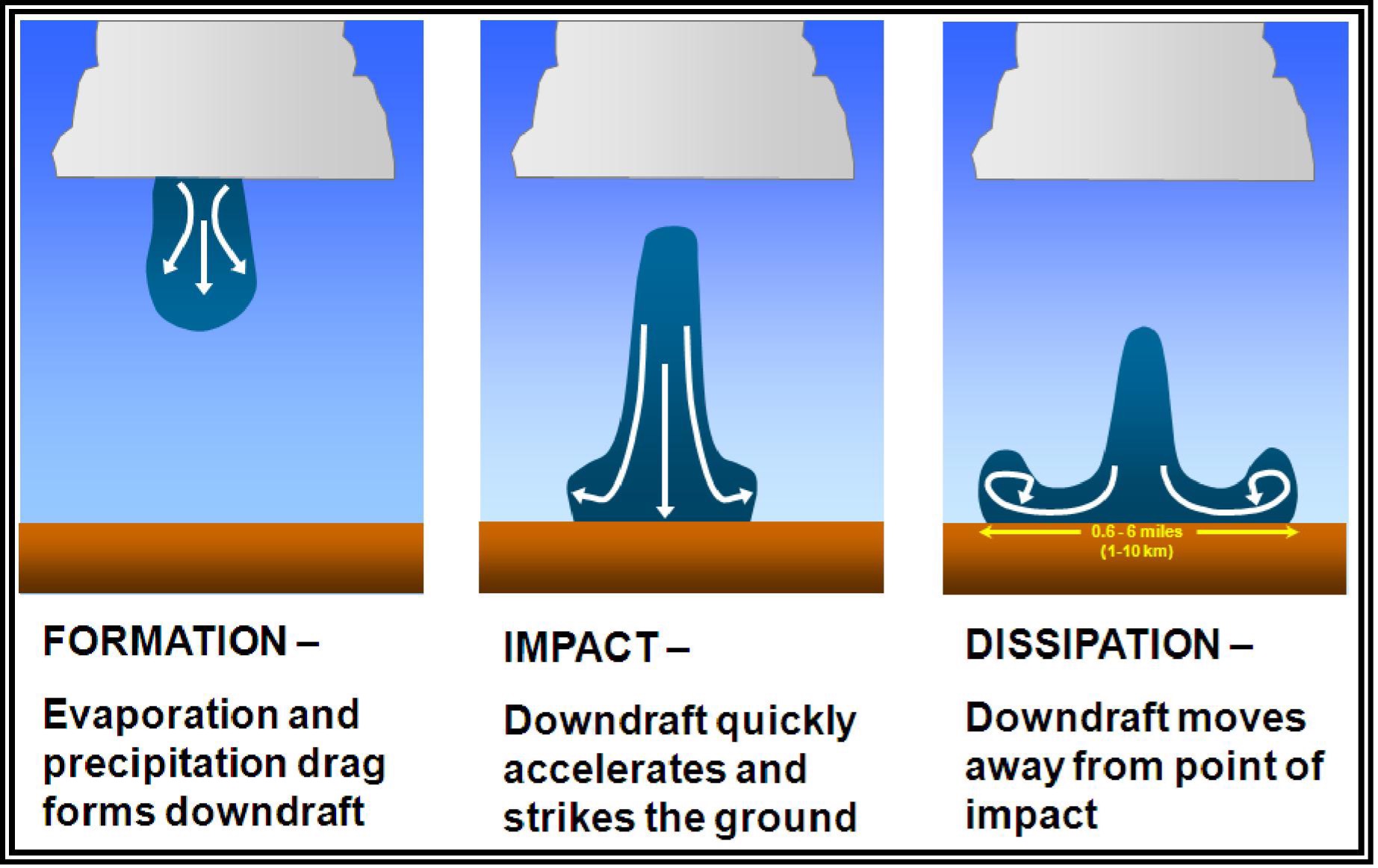
Microbursts can produce wind speeds of 100+ mph at the surface. They’re invisible. You can’t see them coming. If you notice sudden, dramatic wind changes, land immediately.
Turbulence
Types that affect drone operations:
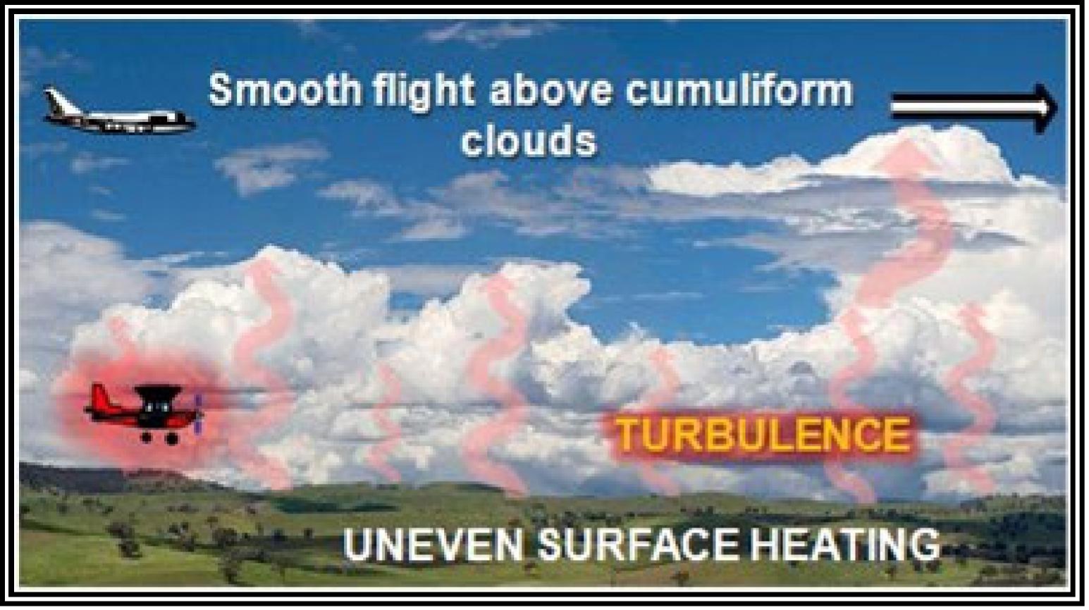
- Convective turbulence: Caused by heated air rising (thermals). Common on hot afternoons.
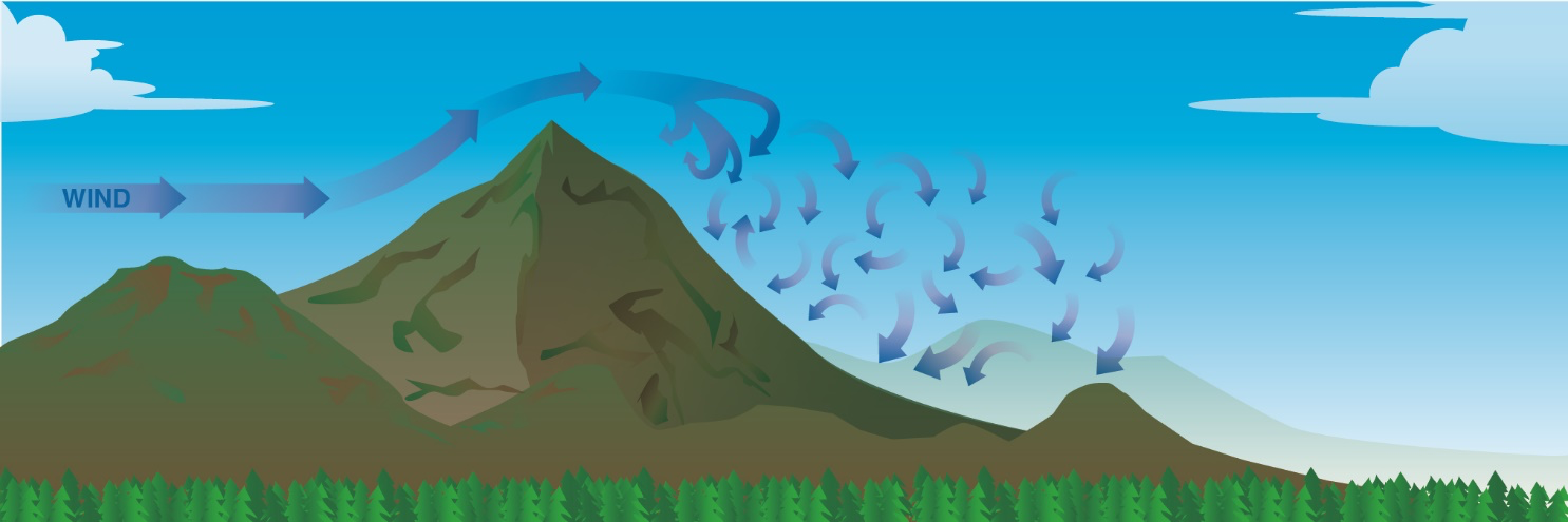
- Mechanical turbulence: Wind flowing over obstacles (buildings, trees, hills). Creates eddies and downdrafts.
- Frontal turbulence: Along weather fronts where different air masses meet.
Fog
Fog is a cloud at ground level. It drops visibility below the Part 107 minimum of 3 statute miles.
Types of Fog
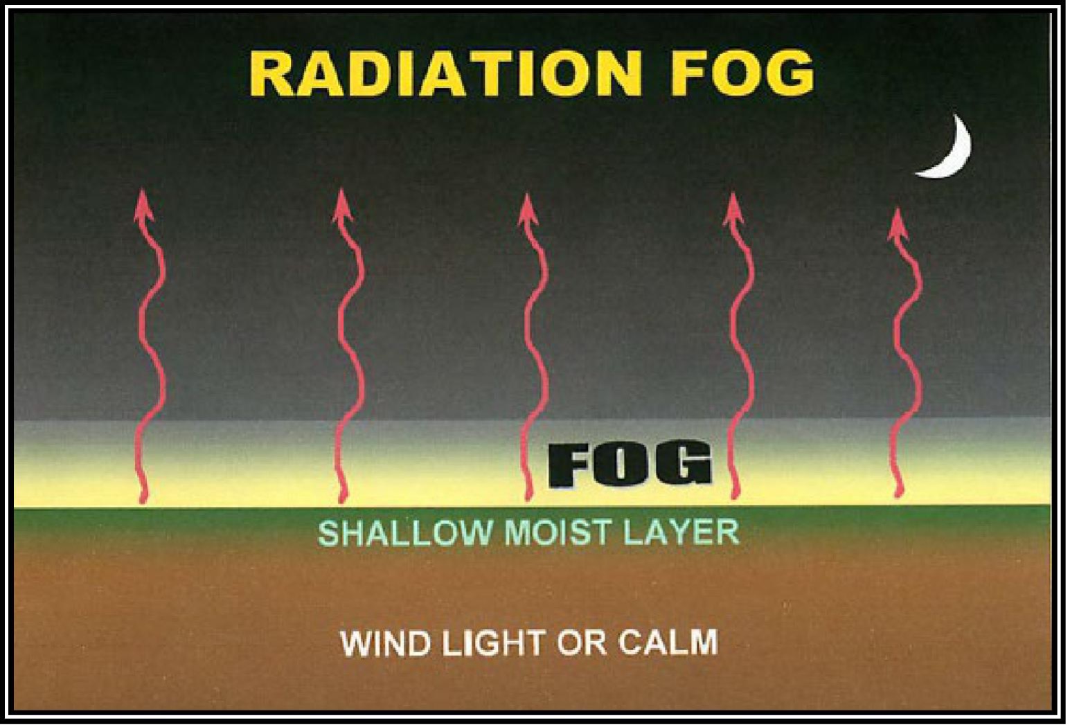
Radiation fog: Forms on clear, calm nights when ground heat radiates into space. Common in valleys. Burns off after sunrise.
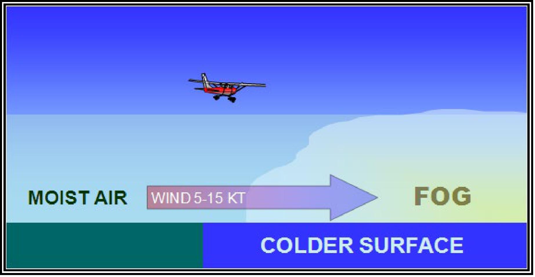
Advection fog: Forms when moist air moves over a cooler surface (warm air over cold water). Common along coastlines.
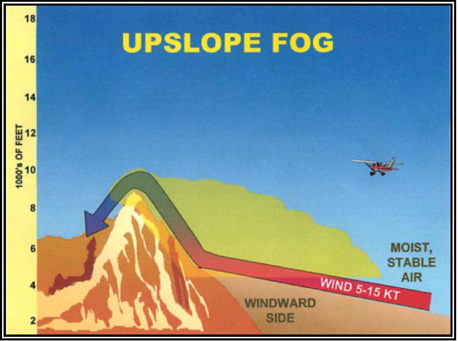
Upslope fog: Forms when moist air is pushed up a slope by wind. Common in mountainous areas.
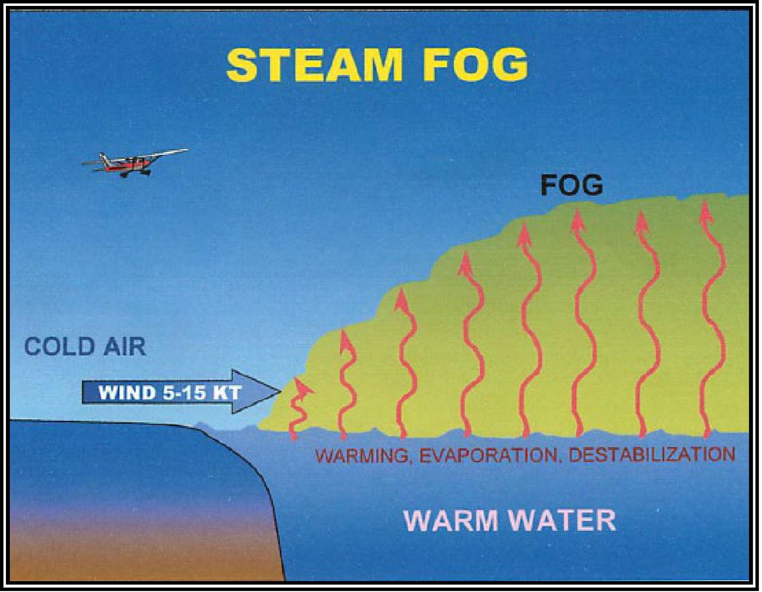
Steam fog (evaporation fog): Forms when cold air moves over warm water. Looks like steam rising.
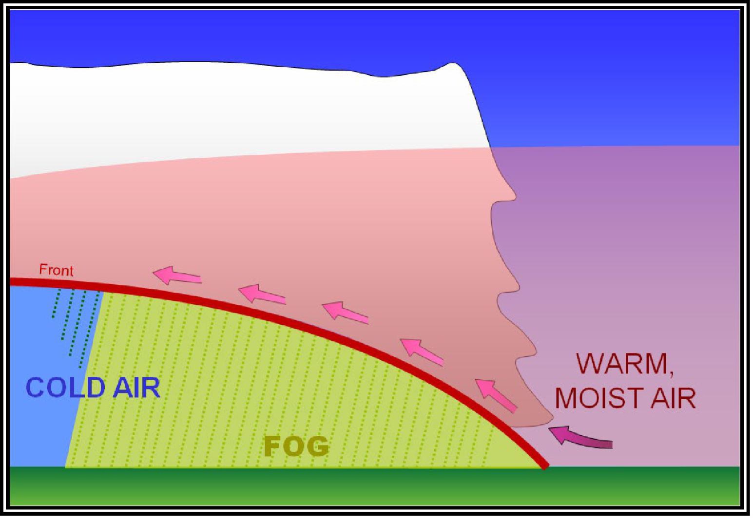
Frontal fog: Forms when rain falls through cold air ahead of a warm front. Lowers visibility along the front.
Icing
Ice accumulation on your drone is extremely dangerous:
- Rime ice: Forms in cold clouds with small droplets. Rough, milky appearance.
- Clear ice: Forms in larger droplets. Smooth, heavy, most dangerous.
- Mixed ice: Combination of both.
Your drone doesn’t have de-icing systems. ANY ice accumulation can make the aircraft unflyable. If you encounter icing conditions, land immediately.
Temperature Inversions
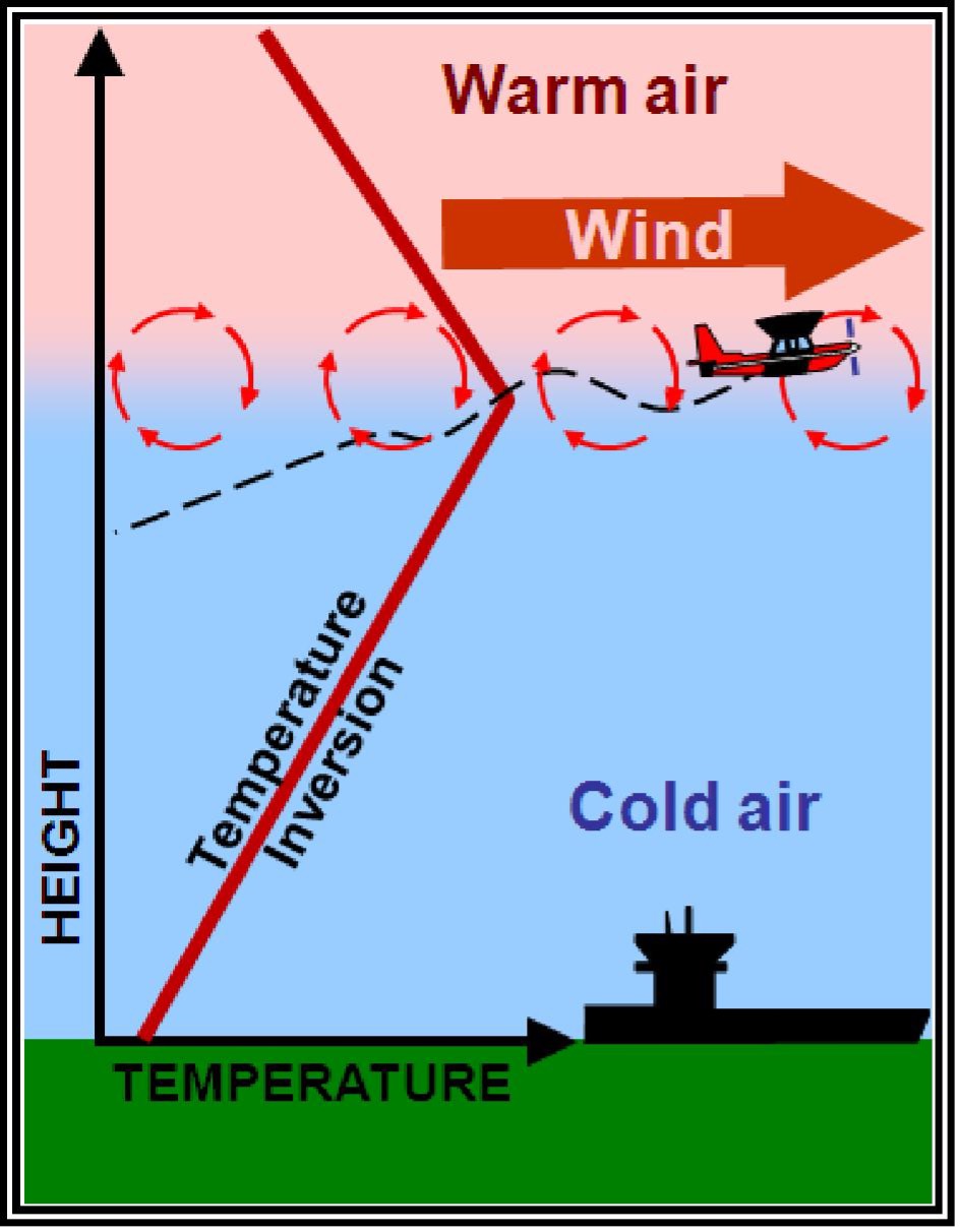
Normally temperature decreases with altitude. An inversion reverses this pattern. Within the inversion layer, temperature actually increases with altitude.
Effects:
- Traps pollutants and haze near the surface (poor visibility)
- Can create smooth air below the inversion layer
- Prevents vertical mixing of air
Visibility and Cloud Clearance Minimums
Part 107 weather minimums. Memorize these:
| Condition | Minimum |
|---|---|
| Visibility | 3 statute miles |
| Distance below clouds | 500 feet |
| Distance from clouds horizontally | 2,000 feet |
“3-500-2000”. Three miles, 500 below, 2,000 horizontal. If conditions are worse, don’t fly.
Quick Check
Q: What are the three ingredients for thunderstorm formation? A: Moisture, instability, and a lifting mechanism.
Q: What is a microburst? A: A concentrated downdraft (less than 2.5 miles across) that can produce 100+ mph winds at the surface.
Q: What are the Part 107 weather minimums? A: 3 statute miles visibility, 500 feet below clouds, 2,000 feet horizontal from clouds.
What’s Next?
Now let’s learn to decode the weather reports that tell you what conditions to expect: METARs and TAFs.
This free course covers the essential knowledge, but if you want video walkthroughs, practice exams, and instructor support, Pilot Institute’s Part 107 course is the most comprehensive option available.