Clouds, Fronts & Atmospheric Stability
The Hydrologic Cycle
All weather starts with water cycling between the earth and atmosphere:
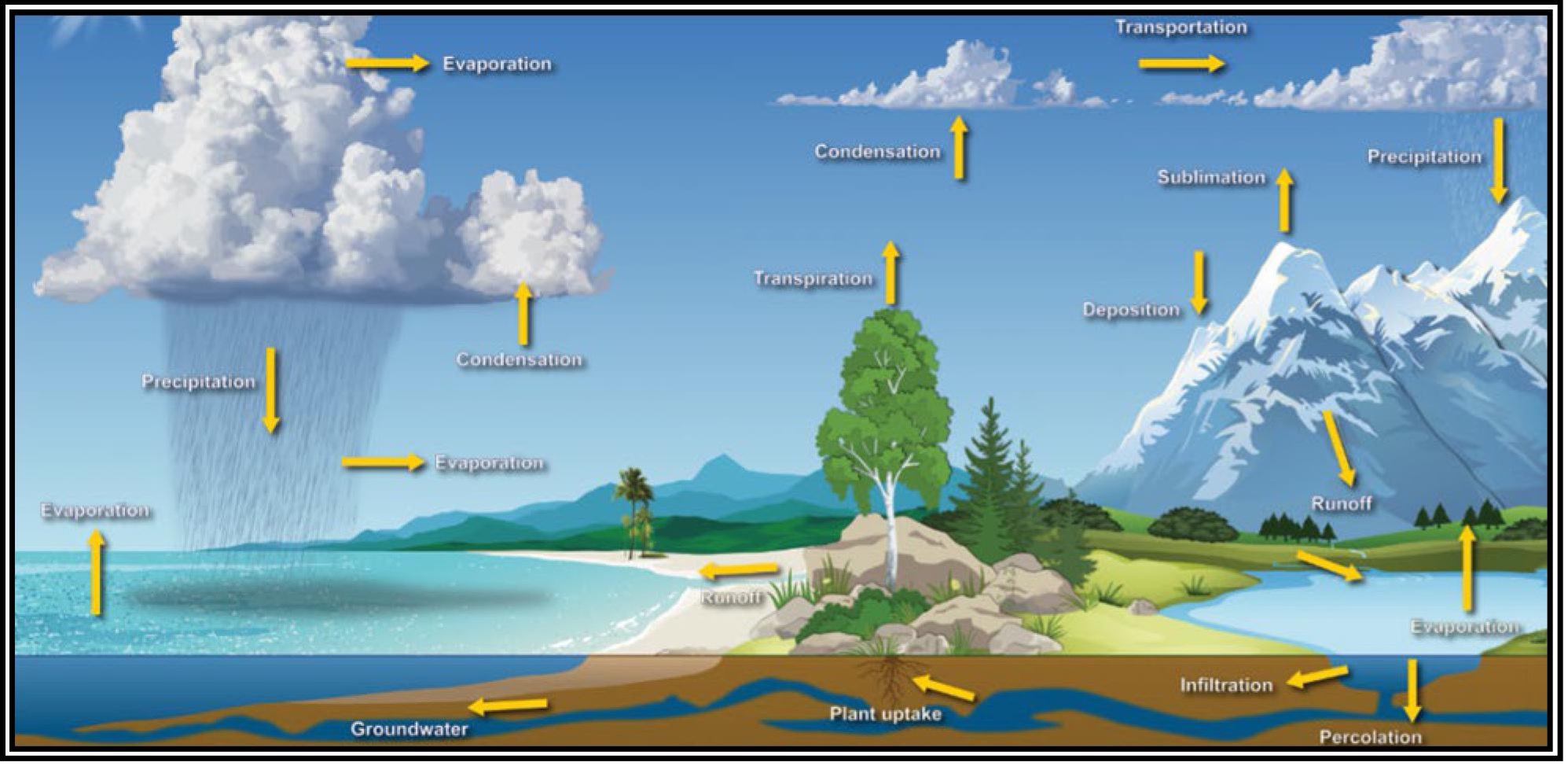
- Evaporation: Water turns to vapor (requires heat)
- Condensation: Vapor turns to water droplets (forms clouds)
- Precipitation: Water falls back to earth (rain, snow, hail)
- The cycle is driven by solar energy
Cloud Types
Knowing basic cloud types helps you assess weather conditions:
Low Clouds (below 6,500 ft AGL)
- Stratus (ST): Flat, featureless, gray layers. Produces steady, light rain.
- Stratocumulus (SC): Low, lumpy clouds with gaps. Usually no precipitation.
- Nimbostratus (NS): Dark gray, thick layers. Steady moderate to heavy rain.
Middle Clouds (6,500 - 20,000 ft)
- Altocumulus (AC): Patchy, rolling clouds. May indicate approaching storms.
- Altostratus (AS): Grayish veil covering the sky. Rain possible.
High Clouds (above 20,000 ft)
- Cirrus (CI): Wispy, feather-like. Usually fair weather but may indicate an approaching front.
- Cirrocumulus (CC): Small, white patches (mackerel sky). Fair weather.
- Cirrostratus (CS): Thin, milky veil. May produce a halo around the sun or moon.
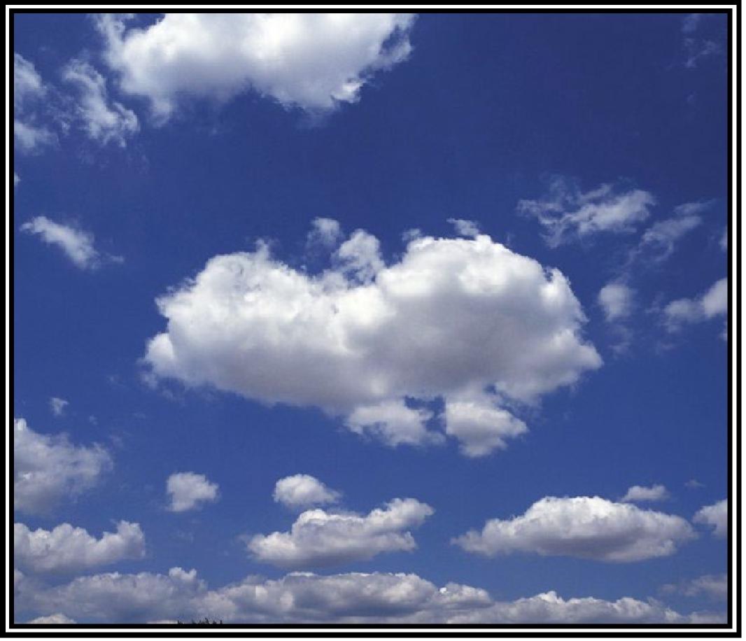
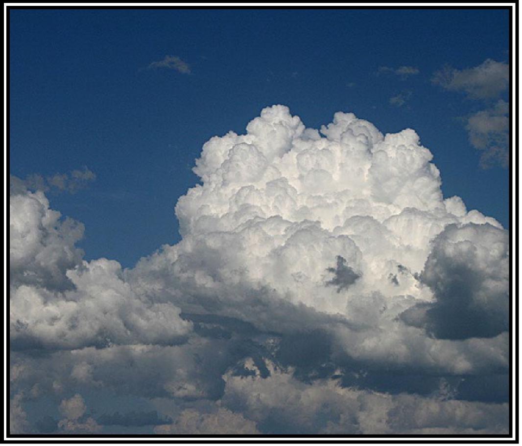
Clouds with Vertical Development
- Cumulus (CU): Puffy, cotton-like. Fair weather when isolated.
- Cumulonimbus (CB): Thunderstorm clouds. EXTREMELY hazardous. Avoid at all costs.
Cumulonimbus (CB) = thunderstorm = do not fly. The FAA always tests this. If you see CB developing, land immediately.
Atmospheric Stability
Stability determines whether air wants to rise or stay put:
Stable Air
- Resists vertical movement
- Smooth air, stratiform clouds, steady precipitation, poor visibility
- Fog and low clouds common
Unstable Air
- Continues rising once started
- Turbulent air, cumulus clouds, showery precipitation, good visibility (except in precipitation)
- Thunderstorms possible
Unstable air means turbulence, which makes it harder to control your drone and get smooth footage. Stable air means smoother flights but potentially worse visibility.
Air Masses
An air mass is a large body of air with similar temperature and moisture throughout:
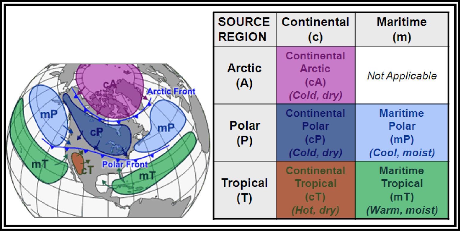
| Air Mass | Source Region | Characteristics |
|---|---|---|
| Continental Polar (cP) | Canada/Alaska | Cold, dry |
| Continental Tropical (cT) | Desert SW | Hot, dry |
| Maritime Polar (mP) | North Pacific/Atlantic | Cool, moist |
| Maritime Tropical (mT) | Gulf of Mexico/Atlantic | Warm, moist |
| Arctic (A) | Arctic region | Very cold, dry |
Fronts
A front is the boundary between two different air masses:
Cold Front
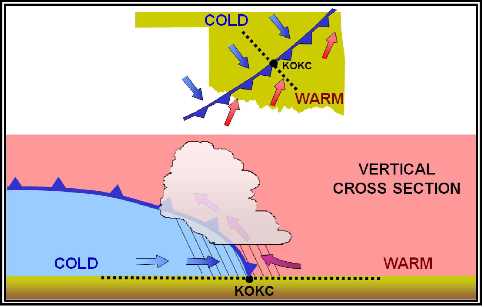
- Cold air advances, pushes under warm air
- Steep slope: rapid lifting, possible thunderstorms
- Moves faster than warm fronts
- Weather: Cumulus/CB clouds, heavy rain, thunderstorms, gusty winds
- Passage: Temperature drops, wind shifts, weather clears quickly
Warm Front
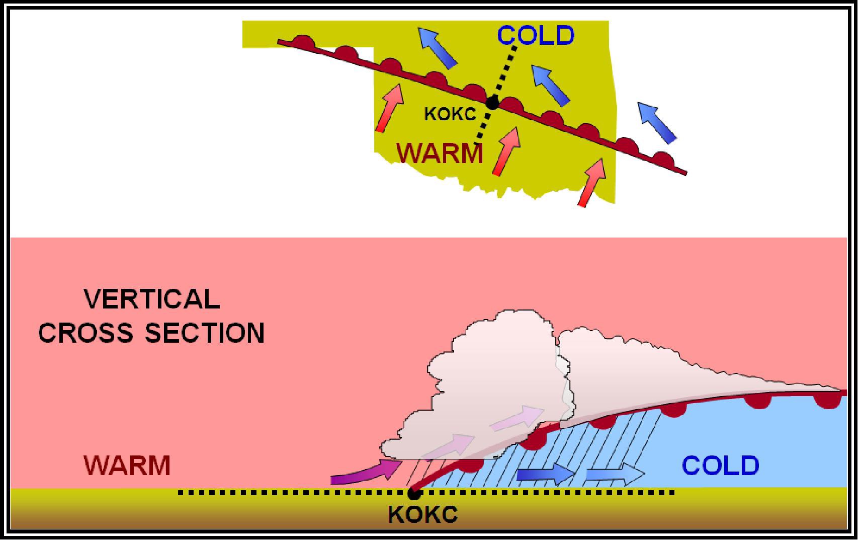
- Warm air advances, slides over cold air
- Gentle slope: gradual lifting, widespread clouds
- Moves slower than cold fronts
- Weather: Stratus/nimbostratus clouds, steady rain, fog
- Passage: Temperature rises, visibility may remain poor
Stationary Front
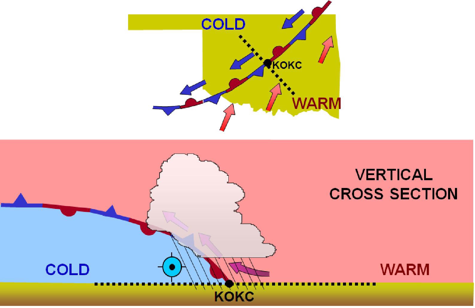
- Neither air mass is moving
- Weather can persist for days in the same area
- Similar conditions to a warm front: overcast, steady rain
Occluded Front
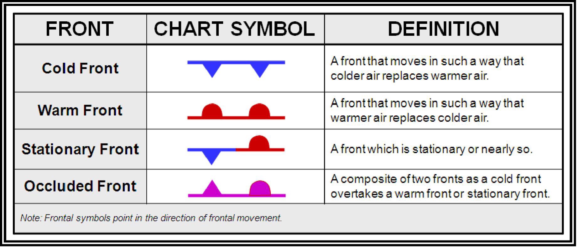
- A cold front catches up to a warm front
- Most complex weather, combining characteristics of both
- Can produce severe weather
Quick Check
Q: Which cloud type indicates thunderstorms? A: Cumulonimbus (CB). Avoid all CB clouds.
Q: What type of weather does a cold front typically bring? A: Thunderstorms, heavy rain, gusty winds. Weather clears quickly after passage.
Q: Stable air produces what type of clouds and precipitation? A: Stratiform clouds, steady precipitation, smooth air, poor visibility.
What’s Next?
Now that we understand weather theory, let’s look at specific hazards: thunderstorms, wind shear, fog, and icing, plus the minimum weather conditions for safe drone operations.
This free course covers the essential knowledge, but if you want video walkthroughs, practice exams, and instructor support, Pilot Institute’s Part 107 course is the most comprehensive option available.