Special Use Airspace
Why Special Use Airspace Matters
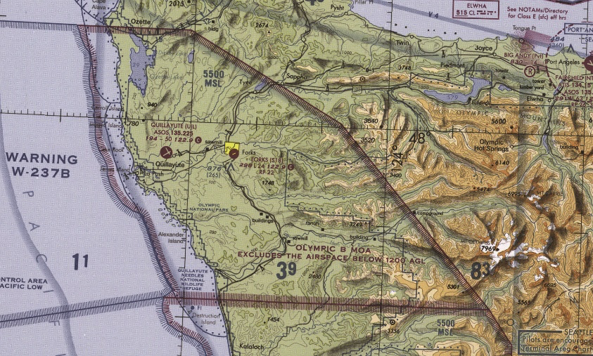
Beyond the standard A-G classification, the FAA designates special use airspace for specific purposes. These areas have unique restrictions that the FAA tests directly. Expect questions about restricted and prohibited areas.
Prohibited Areas
- P- designation (P-56 around the White House, P-40 around Camp David)
- Never fly here. No exceptions, no waivers for drone pilots.
- Shown as blue hatched areas on sectional charts
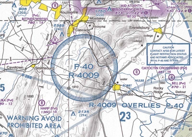
Prohibited areas are absolute no-fly zones. If the FAA shows you one on a chart and asks if you can fly there, the answer is always no.
Restricted Areas
- R- designation (R-2306, R-2508, etc.)
- Contains hazards to aircraft (artillery firing, testing, etc.)
- Flight is prohibited without permission from the controlling agency
- Shown as blue hatched areas with the R- designation
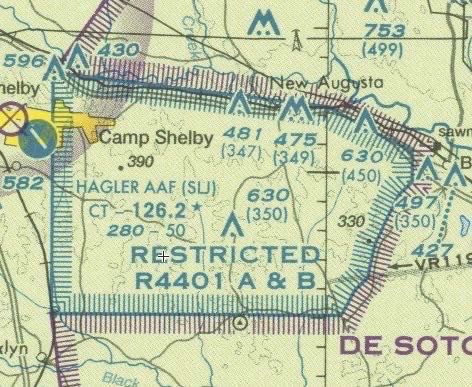
Unlike prohibited areas, restricted areas CAN be flown in, but only with permission from the using/controlling agency. Check the chart legend or chart supplement for contact information.
Restricted Area Information
The top and bottom of each sectional chart includes a table listing restricted areas with:
- Area designation (R-2306A)
- Controlling agency (who to contact for permission)
- Altitude limits (surface to X,000 ft)
- Operating hours (times when the restriction is active)
Military Operations Areas (MOAs)
- Magenta hatched areas with names like “Rainbow MOA” or “Gila MOA”
- Established to separate military training from IFR traffic
- VFR (and drone) flights are not prohibited, but not recommended
- Military aircraft may be conducting high-speed maneuvers at low altitude
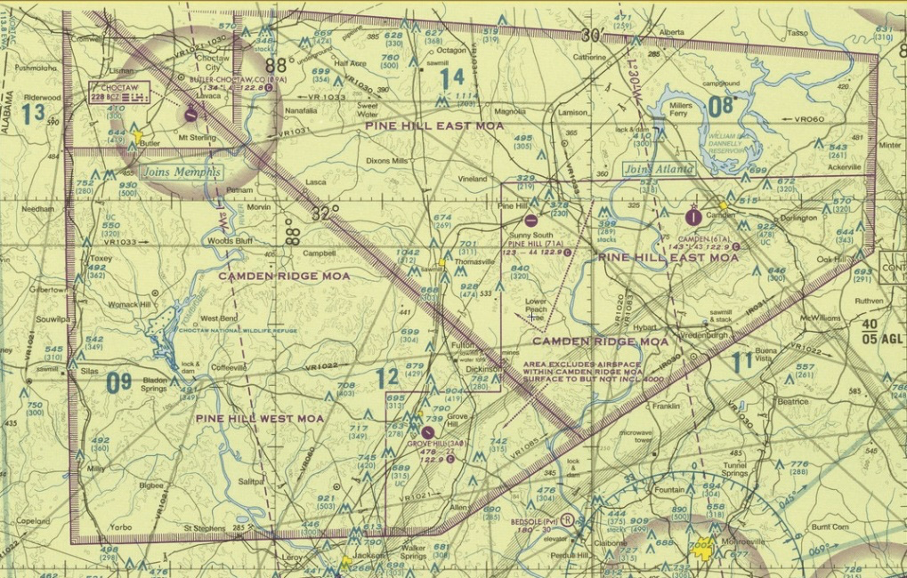
You are allowed to fly in MOAs, but military training may be happening. Exercise extreme caution.
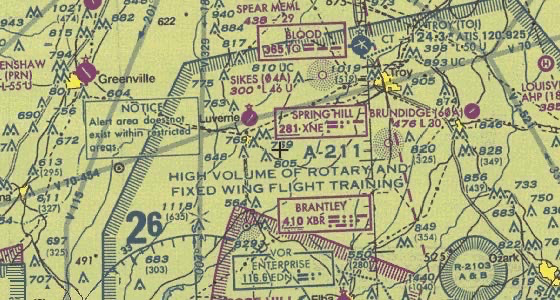
Alert Areas
- Blue hatched areas with A- designation (A-231, etc.)
- High volume of pilot training or unusual aerial activity
- Not restricted. You can fly there.
- Be alert for high-density training operations.
Warning Areas
- International airspace extending 3 nautical miles and beyond from the US coast
- Similar to MOAs but over international waters
- Shown as magenta hatched areas offshore
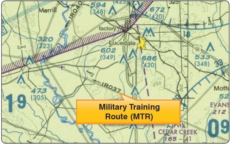
Military Training Routes (MTRs)
- Routes used by military aircraft for low-level, high-speed training
- Shown on sectional charts as light gray lines with route numbers
- IR routes: IFR operations (at least one segment above 1,500 ft AGL)
- VR routes: VFR operations (segments below 1,500 ft AGL)
- 4-digit numbers = generally above 1,500 ft AGL (less hazard)
- 3-digit numbers = segments below 1,500 ft AGL (more hazardous)
Temporary Flight Restrictions (TFRs)
TFRs are dynamic restrictions issued for specific events or emergencies:
- Presidential/VIP movements (TFR around the President’s location)
- Wildfires (no drone flights near firefighting operations)
- Disaster areas (hurricanes, floods)
- Sporting events (stadium TFRs, 3 NM radius, surface to 3,000 ft AGL)
- Space operations (launch/recovery)
ALWAYS check for TFRs before flying. A TFR can be issued at any time and makes otherwise legal airspace temporarily restricted. Check 1800wxbrief.com or your flight planning app.
Other Airspace
Airport Advisory Areas
- Around airports with Flight Service Stations
- 10 NM radius, surface to designated altitude
- Advisory information available but not mandatory
Parachute Jump Areas
- Shown on sectional charts with parachute symbols
- Avoid flying here when active. Jumpers have right-of-way in the air.
Published VFR Routes
- Magenta flag symbols with 5-letter identifiers
- VFR checkpoints for manned aircraft
- Useful for situational awareness
Quick Check
Q: Can you fly in a Restricted Area? A: Only with permission from the controlling agency.
Q: What about an MOA, is flying prohibited? A: No. MOAs are not restricted. You can fly there but should exercise caution due to military training activity.
Q: What is a TFR and when should you check for them? A: Temporary Flight Restriction. Check EVERY time before flying, as they can be issued at any time.
What’s Next?
Now let’s learn to read all this airspace information on sectional charts. This is the single most tested skill on the exam.
This free course covers the essential knowledge, but if you want video walkthroughs, practice exams, and instructor support, Pilot Institute’s Part 107 course is the most comprehensive option available.