The Atmosphere & Density Altitude
Why Weather Matters
Weather accounts for 11-16% of the Part 107 exam, but it affects every flight you’ll ever make. Understanding the atmosphere isn’t just academic. It determines whether your drone can safely fly, how long the battery lasts, and whether you’ll encounter hazardous conditions.
Layers of the Atmosphere
The atmosphere has several layers, but drone pilots only need to understand the lowest:
- Troposphere: Ground level up to ~36,000 ft (varies by latitude and season). This is where ALL weather happens. Temperature decreases with altitude (~2°C per 1,000 ft, or 3.5°F per 1,000 ft).
- Tropopause: The boundary between troposphere and stratosphere. Weather stops here.
- Stratosphere: Above the tropopause. Stable, no weather. Not relevant for drones.
ALL weather occurs in the troposphere. The temperature drops about 2°C per 1,000 ft of altitude gain. This is why it’s colder on mountains.
Standard Atmosphere
The FAA defines a “standard day” as a baseline:
| Parameter | Standard Value |
|---|---|
| Temperature at sea level | 15°C (59°F) |
| Pressure at sea level | 29.92 inHg (1013.25 hPa) |
| Temperature lapse rate | 2°C per 1,000 ft |
| Pressure lapse rate | ~1 inHg per 1,000 ft |
This baseline is what altimeters and performance charts reference. When actual conditions differ from standard, aircraft performance changes.
Atmospheric Pressure
Air has weight. Atmospheric pressure is the weight of air pushing down on a given area.
- High pressure = descending air, generally clear weather
- Low pressure = rising air, generally cloudy or stormy weather
- Pressure decreases with altitude (less air above you)
How Pressure Affects Drones
- Higher pressure = denser air = more lift for propellers = better performance
- Lower pressure = thinner air = less lift = reduced performance
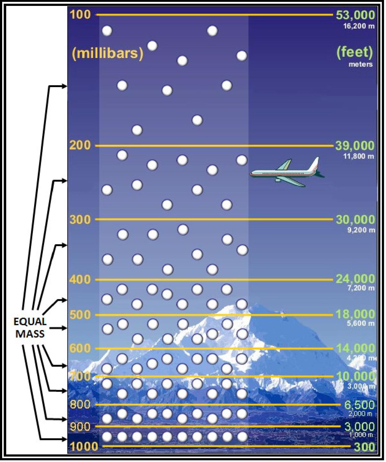
Density Altitude — The Performance Killer
Density altitude is pressure altitude corrected for non-standard temperature. It’s the altitude the aircraft “feels” like it’s at.
- High density altitude = thin air = poor performance (longer takeoff, reduced climb, shorter battery)
- Low density altitude = dense air = good performance
What Increases Density Altitude
- High temperature — hot air is less dense
- High altitude — less air pressure at elevation
- High humidity — water vapor is lighter than dry air
- Low pressure — weather systems can reduce pressure
Density altitude is “high” when conditions are bad for performance. Think: “high density altitude = high PERFORMANCE RISK.” Hot days at high elevation are the worst case.
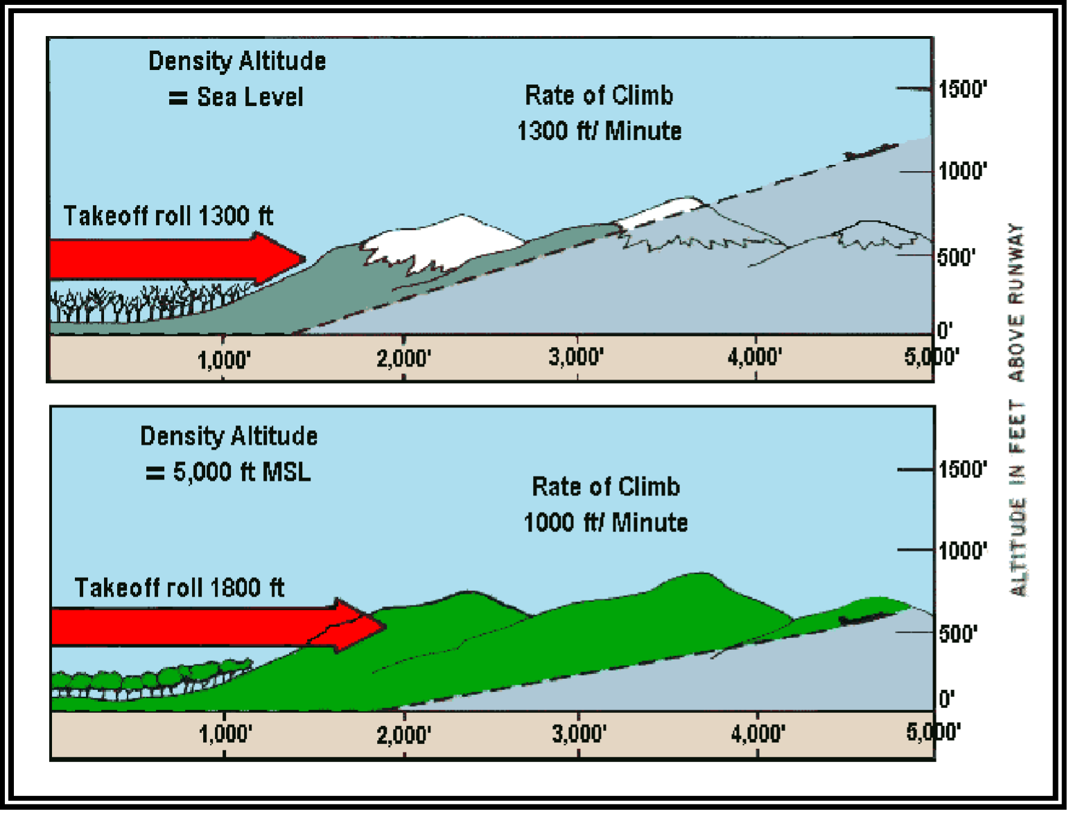
Practical Impact
- A drone that flies 30 minutes at sea level on a cool day might only fly 20 minutes at 5,000 ft on a hot day
- Propellers have less “bite” in thin air
- The drone may struggle to maintain altitude, especially with a payload
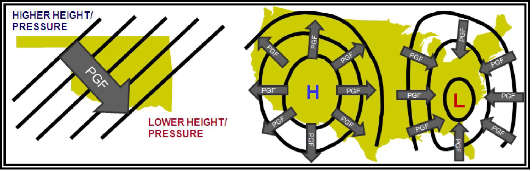
Wind
Wind is air moving from high pressure to low pressure. Several forces affect wind direction:
- Pressure Gradient Force (PGF): Moves air from high to low pressure
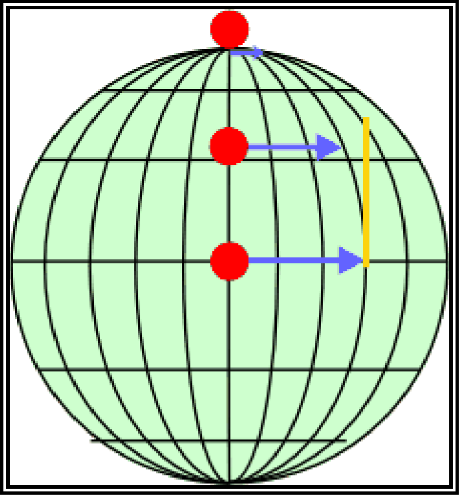
- Coriolis Effect: Deflects wind to the right (Northern Hemisphere) due to Earth’s rotation
- Friction: Slows wind near the surface
Surface vs Upper-Level Wind
- Surface wind: Affected by friction from terrain, buildings, trees. Slower and more variable.
- Upper-level wind: Less friction, faster, more consistent. Shown on wind charts.
You’re flying in the surface wind layer. Buildings, hills, and trees all create turbulence and wind shadows that can surprise you.
Quick Check
Q: What is the standard temperature at sea level? A: 15°C (59°F).
Q: What four factors increase density altitude? A: High temperature, high altitude, high humidity, low pressure.
Q: Does high density altitude improve or reduce drone performance? A: Reduces performance. The air is thinner, providing less lift.
What’s Next?
Now let’s learn about clouds, fronts, and atmospheric stability: the building blocks of weather patterns that determine safe flying conditions.
This free course covers the essential knowledge, but if you want video walkthroughs, practice exams, and instructor support, Pilot Institute’s Part 107 course is the most comprehensive option available.