Aerial Landscape Photography
Landscapes Are Why People Buy Drones
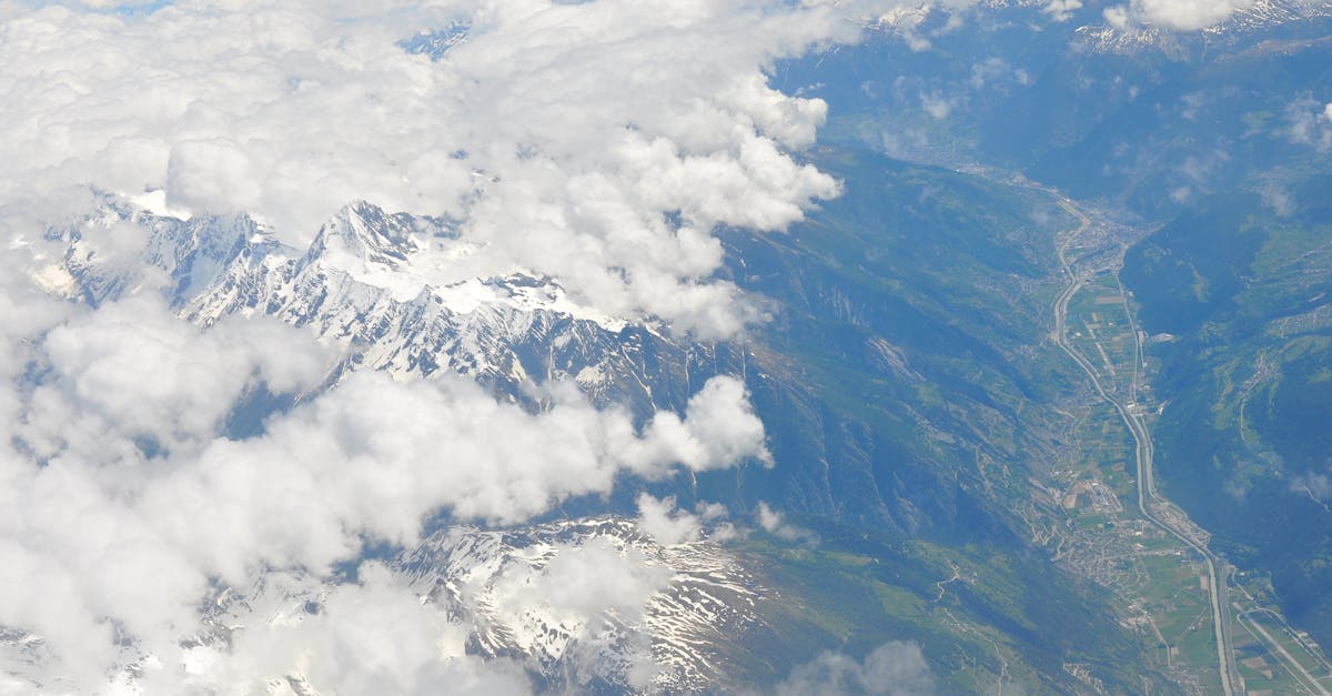
The number one reason people pick up drone photography is to capture landscapes they can’t photograph from the ground. Mountain ranges, coastlines, valleys, rivers, and deserts all transform when seen from 100-300 feet up.
Choosing Your Altitude
Altitude is your primary creative tool in landscape photography:
| Altitude | Effect | Best For |
|---|---|---|
| 20-50 ft | Intimate, includes foreground detail | Rivers, trails, small scenes |
| 50-150 ft | Shows landscape context with detail | Most landscapes, general use |
| 150-300 ft | Sweeping vistas, full context | Mountain ranges, coastlines |
| 300+ ft | Map-like, loses intimacy | Generally too high for compelling photos |
Most aerial landscapes are shot between 50-150 feet: high enough to see the big picture, low enough to maintain texture and detail. Photos from 400 feet tend to look like satellite imagery.
The Landscape Photo Checklist
Before you press the shutter, verify:
- Subject identified: what’s the focal point of this image?
- Sun direction: is the light enhancing or flattening the scene?
- Foreground interest: something close that anchors the image
- Horizon level: check the gimbal angle and level the horizon
- Exposure balanced: check the histogram, protect highlights
- Multiple angles: don’t shoot from just one position; fly around the subject
Capturing Scale
The biggest challenge in aerial landscape photography is conveying scale. A mountain range from above can look like a wrinkled blanket without reference points.
Include scale references:
- A person standing on a cliff edge
- A car on a road winding through the valley
- A boat in a harbor
- A building in a landscape
These give viewers a sense of the scene’s size.
Foreground, Middle Ground, Background
Strong landscape photos (aerial or ground) have depth through three layers:
- Foreground: closest to the camera (a ridge, trees, a cliff edge)
- Middle ground: the main subject area (a valley, lake, town)
- Background: the distant scenery (mountains, sky, sunset)
Even from the air, positioning your drone to capture all three layers creates a stronger image than a flat, single-plane shot.
Dealing With Dynamic Range
Landscapes often have bright skies and dark foregrounds. That’s more dynamic range than your camera can capture in a single shot. Solutions:
AEB (Auto Exposure Bracketing)
Set your drone to AEB mode. It takes 3-5 photos at different exposures in rapid succession. Merge them into an HDR image in Lightroom. This is the professional approach.
Expose for Highlights, Recover Shadows
Underexpose slightly to protect the sky, then lift shadows in Lightroom. RAW files have enough dynamic range for this. JPEGs don’t.
Graduated Filters in Editing
Apply a digital graduated filter in Lightroom to darken the sky while brightening the foreground.
Overexposed sky (pure white pixels) contains zero data. No editing tool can recover detail that wasn’t captured. Always protect highlights. It’s easier to brighten shadows than to recover clipped highlights.
Quick Check
Q: What altitude produces the most compelling landscape photos? A: 50-150 feet. High enough for context, low enough for texture and detail.
Q: Why do you need scale references in aerial landscapes? A: Without something recognizable (person, car, building), viewers can’t tell the size of the scene. Mountains can look like wrinkles.
Q: How do you handle high dynamic range landscapes? A: Use AEB bracketing to capture multiple exposures, then merge into HDR in Lightroom.
What’s Next?
Landscapes captured. Now let’s explore two powerful techniques: HDR merging and panorama stitching.
Pilot Institute: see the world from a new perspective.