Shooting in Different Environments
Why It Matters
A technique that produces strong footage over a beach might fall flat over a mountain. Each environment has its own characteristics: scale, texture, light behavior, and obstacle patterns. Understanding what works where separates reliable results from guesswork.
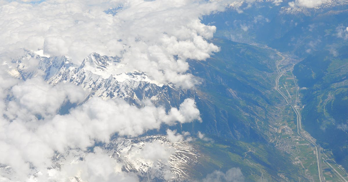
Mountains and Hills
What Makes Mountains Unique
- Massive scale: subjects look tiny from any altitude
- Dramatic light and shadow from ridgelines
- Weather changes rapidly: clouds, wind, fog roll in fast
- Altitude and wind are your biggest challenges
Techniques
- The Reveal Shot: start low, facing a close subject (trees, rocks, yourself), then fly backwards and upward to reveal the mountain landscape beyond. This creates a sense of scale impossible in a static shot.
- Fly through valleys: position the drone in a valley opening and fly forward to reveal the landscape. The valley walls create a natural frame.
- Use mist and fog: send the drone down into mist, then rise above it. The contrast between fog-covered valleys and clear peaks is striking. In post, reverse the footage for a “climbing out” effect.
- Altitude: mountains require higher flying (200-400 feet) to show the landscape’s scale. Low altitude in mountains just shows trees.
Mountain wind is unpredictable and dangerous for drones. Ridge lines create turbulence, and valley winds can exceed your drone’s maximum speed. Check wind at altitude (not just ground level), and always have a return-to-home altitude set above the highest terrain feature between you and the drone.
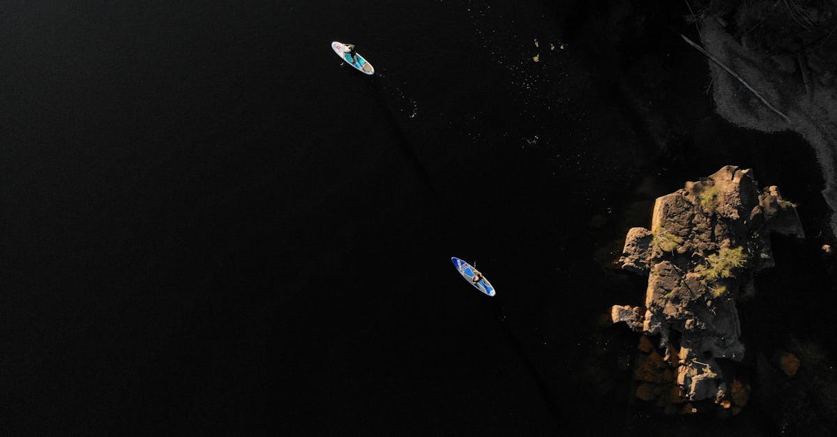
Coastlines and Beaches
What Makes Coastlines Unique
- Natural leading lines: the waterline draws the eye
- Color gradients: deep water, shallow water, sand, vegetation
- Changing conditions: tides, waves, and light shift constantly
- Open space: fewer obstacles than most environments
Techniques
- Follow the waterline: fly parallel to the coast at 50-100 feet. The line between water and sand is a natural composition guide.
- Top-down water patterns: shoot straight down at -90 degrees to capture wave patterns, foam lines, and color transitions. This is where the drone’s unique perspective stands out.
- Low-altitude water shots: fly at 5-10 feet above the water for a strong foreground and a sense of speed. Only attempt in calm conditions with visual line of sight.
- Add a human element: a person on the beach, a surfer, a boat. The human element gives scale to the vast coastline.
Forests
What Makes Forests Unique
- Dense canopy blocks GPS signals and visibility
- Trees are obstacles at every altitude below the canopy top
- The texture from above is a uniform green (or vivid autumn colors)
- Fly-through shots are possible but risky
Techniques
- Top-down canopy texture: from 300-400 feet, the forest canopy becomes a textured color field. Autumn forests are especially photogenic from directly above.
- Fly-through gaps: find natural openings in the canopy (river valleys, clearings) and fly through them. Maintain constant altitude and speed. Assess the area from a high vantage point first.
- Edge shots: the boundary between forest and open land creates a strong line. Position the drone along the treeline and fly parallel to it.
- Low level through trees: only in sparse forests with clear paths. Keep line of sight at all times.
Dense forest canopies block GPS signals. Your drone may switch to ATTI mode (no GPS stabilization), making it harder to control and hover. Avoid flying below the canopy in dense forests. If you lose GPS, fly up and out immediately.
Cities and Urban Areas
What Makes Cities Unique
- Complex airspace restrictions: check B4UFLY or LAANC before flying
- Dense obstacles: buildings, power lines, cranes, birds
- People everywhere: legal and safety requirements
- Rich geometric patterns from above: grids, circles, intersections
Techniques
- Geometric top-downs: roads, intersections, parking lots, and building rooftops create graphic patterns from above. Best at 200-400 feet, gimbal at -90 degrees.
- Building reveals: start facing a building close-up, fly backward and up to reveal the cityscape. Works with any prominent building.
- Bridge and highway shots: infrastructure from above shows traffic patterns and engineering geometry.
- Golden hour cityscape: low sun creates long shadows between buildings and warm light on glass and steel. This is when cities look best from the air.
Deserts and Arid Landscapes
What Makes Deserts Unique
- Minimal obstacles: wide open flying
- Dramatic shadow patterns from sand dunes and rock formations
- Heat haze can affect image quality at midday
- Extreme temperatures affect battery performance
Techniques
- Low-angle dune shadows: shoot during golden hour when dunes cast long shadows. The interplay of light sand and dark shadow creates graphic compositions.
- Texture from above: sand patterns, dried riverbeds, and rock textures look like abstract art from directly above.
- Scale with vehicles or people: the vastness of desert landscapes needs a scale reference (a car, a person, a camel train).
Desert heat degrades battery performance significantly. In temperatures above 95°F (35°C), expect 20-30% less flight time. Keep batteries in a cooler before flying, and never leave them in a hot car. The drone itself may warning-shutdown if it overheats.
Quick Check
Q: What’s the best technique for capturing mountain scale? A: The reveal shot. Start low and close, then fly backwards and upward to reveal the landscape. This creates a sense of scale that a static wide shot can’t achieve.
Q: Why are forests dangerous for drones? A: Dense canopies block GPS signals, creating ATTI mode instability. Trees are obstacles at every altitude below the canopy. Lost drones in forests are extremely difficult to recover.
Q: What’s the key to desert photography from above? A: Timing. Golden hour creates long dune shadows that become the composition. Midday heat haze ruins image quality and reduces battery performance.
What’s Next?
Environments covered. Now let’s tackle the most dramatic and most challenging time to fly: after dark.
Pilot Institute: adapt to every landscape.