How to Start a Drone Surveying Business: Complete Guide
Drone surveying has a higher barrier to entry than photography — and that's exactly why it pays so much more. Here's how to break in.
The standard drone photography market is getting crowded. Everyone with a drone is shooting real estate listings or local weddings. Nothing wrong with that — but if you want to separate yourself and significantly boost your income, look into drone surveying.
Here’s the golden rule: a higher barrier to entry equals significantly higher pay. Drone surveying isn’t about taking pretty pictures. It’s about capturing highly precise spatial data that professionals use to make expensive decisions. If you’re willing to learn the technical side, the financial rewards are massive.
What is Drone Surveying?
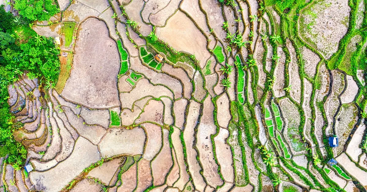
Drone surveying is the process of using drones to create accurate maps, 3D models, and exact measurements of land and structures.
Instead of sending a crew of traditional surveyors out with heavy total stations and GPS rovers to hike across a site for weeks, you fly a drone over the same area for a few hours and generate the same topographical data. By taking hundreds of overlapping photos from above, specialized software stitches them together using photogrammetry to create mathematically accurate digital models.
These aren’t stylized satellite images. They’re precise models that civil engineers, architects, and developers use to extract distances, cut-and-fill volumes, and elevation data down to the centimeter.
Key Industries That Need Drone Surveys
Almost every industry that deals with the physical ground:
- Construction — Pre-construction planning, tracking earthwork progress weekly, verifying final grades
- Mining — Calculating material moved, extracted, or stockpiled
- Agriculture — Crop health analysis, drainage planning, irrigation monitoring
- Land management — Coastal erosion tracking, wetland restoration, forest management
- Government agencies — Infrastructure inspection, emergency response, park mapping
If a company needs to know the shape, volume, or topography of land, they’re a prime candidate.
Required Equipment
You can’t do high-end surveying with a basic consumer drone. You need professional-grade gear.
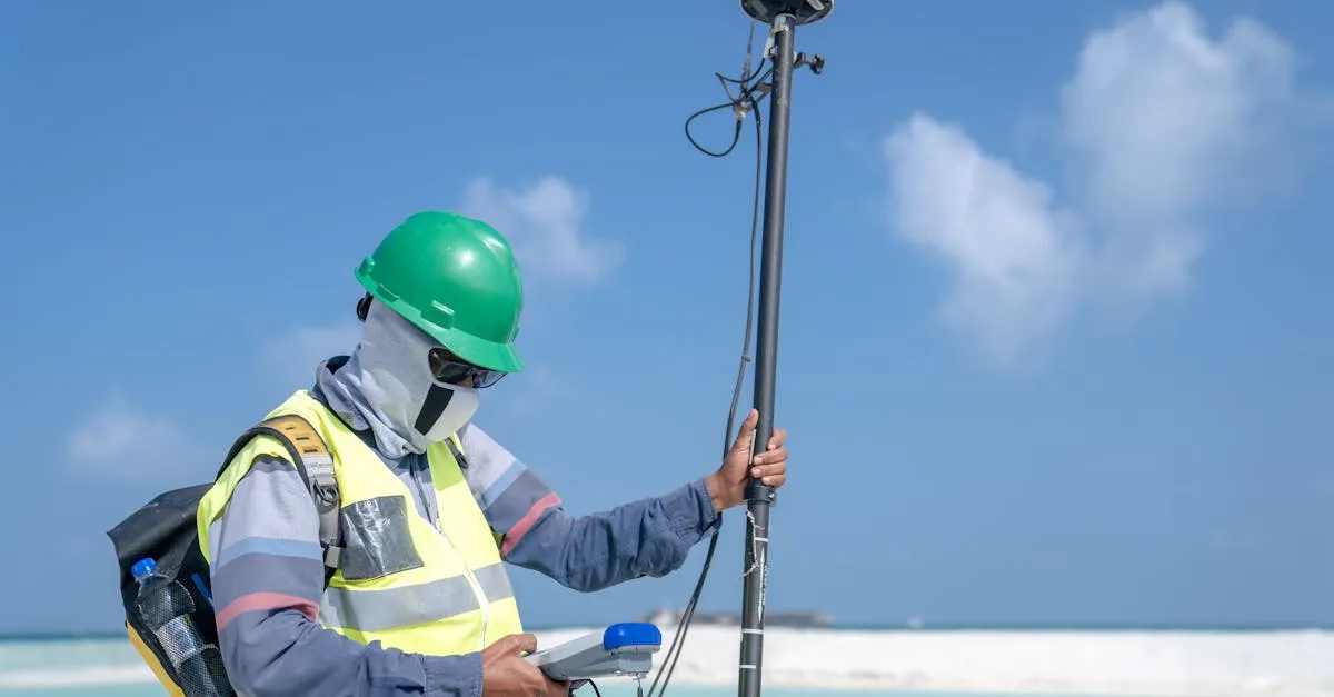
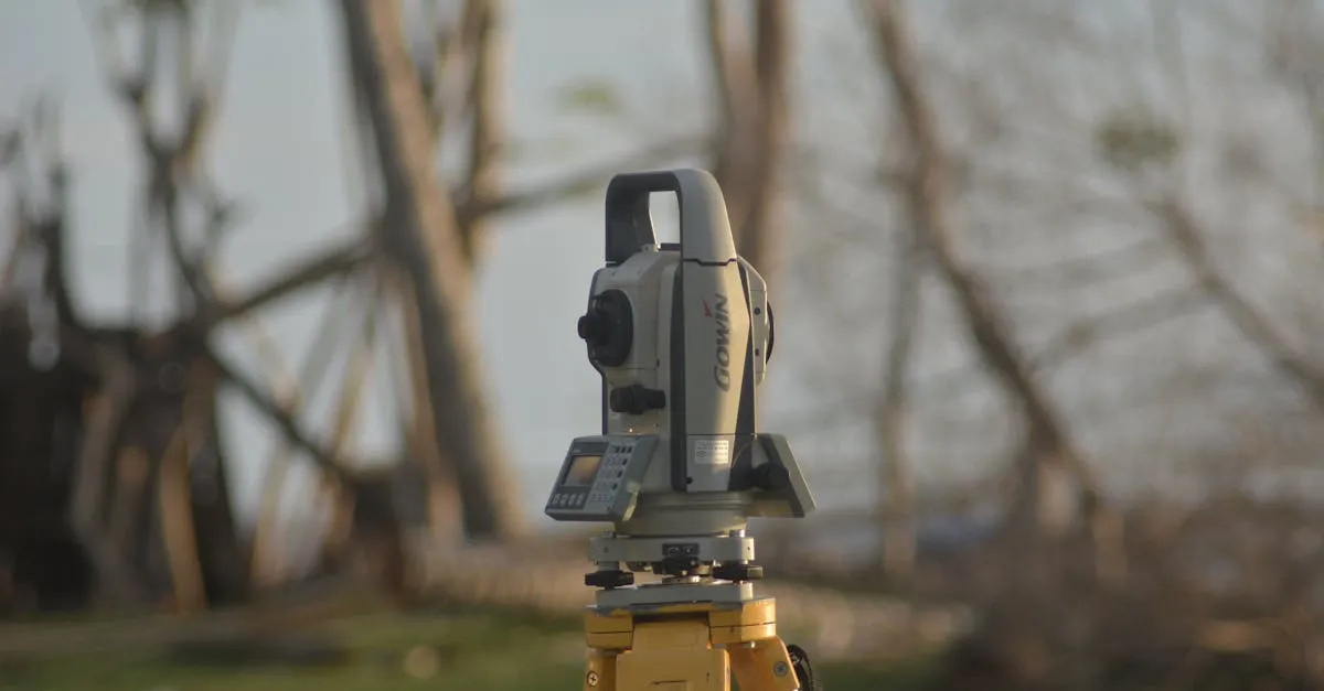
RTK-enabled drone — RTK (Real-Time Kinematic) positioning connects your drone to a network of base stations, correcting GPS errors in real-time for centimeter-level accuracy. The DJI Mavic 3 Enterprise packs enterprise-level RTK capabilities and a mechanical shutter into a portable form factor. For larger industrial sites, DJI Matrice series drones are the industry standard.
Ground Control Points (GCPs) — Highly visible targets placed on the ground at known coordinates. They verify and lock in absolute accuracy, ensuring your data aligns with existing surveyed infrastructure.
Mapping software — The industry standards:
- DroneDeploy — Great for ease of use and cloud processing
- Pix4D — Incredibly powerful, widely accepted in engineering circles
- Agisoft Metashape — Favorite for deep, customized photogrammetry workflows
Required Knowledge: The Technical Side
Buying the gear is the easy part. Here’s what you need to master:
Photogrammetry fundamentals — How light, lenses, and geometry turn 2D photos into 3D models.
Ground Sampling Distance (GSD) — The physical size of each pixel in your real-world map. If your GSD is 2 cm/pixel, one pixel represents 2 centimeters on the ground. GSD directly dictates accuracy.
Flight planning for mapping — Calculate the right overlap (70-80% front, 65-70% side), altitude, and speed. Completely different from manual cinematic flying.
Coordinate systems and projections — Surveyors use localized grid systems like State Plane Coordinates or UTM, tied to specific vertical and horizontal datums. The wrong coordinate system makes your data useless.
Processing workflows — Handle noise, filter moving objects, and export clean, CAD-ready files.
Certifications
At minimum, you need your FAA Part 107 certificate. But in the surveying world, that’s just the starting line.
ASPRS Certified Photogrammetrist — Proves you have a deep, peer-reviewed understanding of mapping science and data accuracy.
State surveying laws — In almost every state, drawing legal property lines is strictly regulated. You can collect topographical data, but you often can’t sign off on boundary surveys without a Professional Land Surveyor (PLS) license. The workaround: partner with local PLS firms. You fly and process topography, they handle legal boundaries and stamp the final drawing. A highly lucrative win-win.
Pricing Your Services
Because the barrier to entry is higher, you charge a massive premium:
- Hourly: $200-500 per hour of flight and processing time
- Per-project: $1,000 for small residential topographical maps, $5,000+ for large mining or construction sites
When quoting, factor in acreage, required accuracy, turnaround time, and specific deliverables (3D meshes, classified point clouds, CAD contour lines).
Most experienced surveyors prefer project-based pricing — as you get faster, hourly pricing punishes your efficiency.
Finding Your First Clients
Go where the dirt is moving:
- Earthwork and grading contractors who need to track material movement
- Civil engineering firms that need topographical data for site designs
- Mining operations, quarries, and aggregate producers needing frequent surveys
- Local government agencies — city planners, public works, parks, transportation
- Land developers plotting new neighborhoods or commercial zones
Building Your Portfolio
You won’t land a $5,000 mining contract with real estate photos in your portfolio. You need to prove you can handle complex spatial data.
If you don’t have paying clients yet:
- Volunteer for local nonprofits — map a nature reserve, community garden, or park
- Create sample maps of public land — find interesting terrain, fly it, process the data, put results on your website
- Show side-by-side comparisons of your 3D model, orthomosaic map, and extracted contour lines
In the surveying world, seeing the quality of your data is believing.
Make the Leap
Starting a drone surveying business is one of the smartest moves a commercial pilot can make. It shields you from the race-to-the-bottom pricing of basic photography and positions you as a highly paid technical professional. Yes, there’s a learning curve. Yes, the software can be frustrating. But once you master the skills, you have a highly scalable, profitable business model.
Frequently Asked Questions
How much money can you make with a drone surveying business? Surveyors charge $200-500 per hour for flight and processing. Small residential topographical maps run $1,000+. Large mining and construction site surveys command $5,000+ per project.
Do you need insurance for a drone surveying business? Yes, commercial drone insurance is essential. You’ll want liability coverage to protect against property damage or injuries, plus hull coverage for your expensive RTK drone equipment. Many government agencies and large construction firms require proof of insurance before awarding contracts.
How long does it take to process drone survey data? A small 10-acre residential site might take 30-60 minutes in DroneDeploy’s cloud. A large 500-acre mining operation could take several hours to overnight. Complex 3D mesh outputs take significantly longer than simple orthomosaic maps.
Can you survey without a surveyor’s license? Yes, you can collect topographical data without a PLS license. But you cannot sign off on legal boundary surveys. Partner with licensed PLS firms instead — you handle the topography while they stamp the final drawings.
What is Ground Sampling Distance (GSD)? The physical size of each pixel in your real-world map. A 2 cm/pixel GSD means one pixel equals 2 centimeters on the ground. GSD directly determines your survey’s accuracy.
What flight settings should you use for drone mapping? 70-80% front overlap and 65-70% side overlap. Mapping requires calculated altitude, speed, and consistent grid patterns for proper image stitching — completely different from manual cinematic flying.
Tired of competing with every amateur drone pilot for $200 real estate shoots? Drone surveying demands real skill, commands premium rates, and positions you as a technical professional. Surveyors charge $200-500 per hour, with large mining and construction projects commanding $5,000+. The learning curve is your competitive moat.
Ready? Check out our free Drone Mapping Course to master the technical skills, and when you’re ready to land high-paying clients, enroll in our free Drone Surveying Business Course.