Construction Monitoring with Drones: Complete Workflow
Construction companies need weekly aerial data — orthomosaics, 3D models, volume calculations. Here's the complete workflow from flight planning to deliverables.
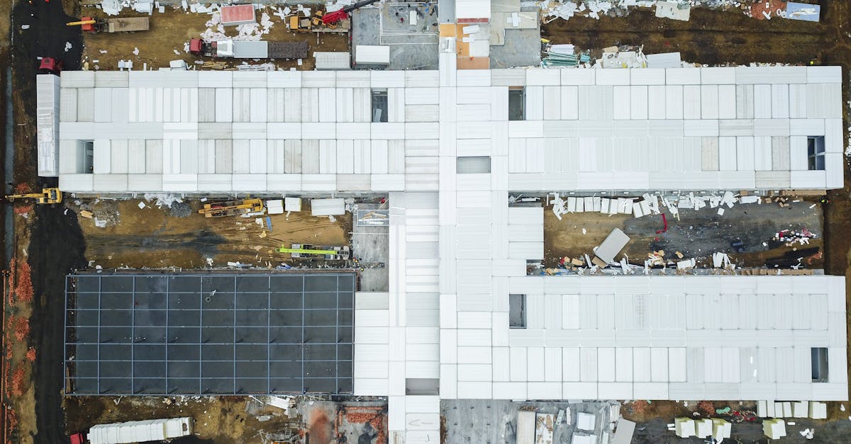
Construction companies are under pressure to build faster, safer, and cheaper. Drones solve critical pain points: progress tracking, site mapping, safety compliance, dispute resolution, and stakeholder communication.
The Complete Workflow
Pre-flight Planning
Define flight path based on site boundaries. Set Ground Sampling Distance (GSD) for adequate resolution. Check airspace and secure LAANC authorization.
Data Capture
Execute systematic grid flights with 80% front overlap and 70% side overlap. Maintain consistent altitude. Use RTK drone or place Ground Control Points (GCPs) for survey-grade accuracy.
Data Processing
Upload images to photogrammetry software (DroneDeploy, Pix4D, or Agisoft). The software analyzes overlapping photos to build 3D geometry.
Deliverables
Process raw data into actionable assets: orthomosaic maps, 3D models, volume calculations, and progress comparison overlays.
Reporting
Compare current map to previous flight. Annotate changes and potential issues. Package for stakeholder distribution.
Types of Deliverables
- Orthomosaic maps — Geometrically corrected aerial photo for precise measurements
- Digital Elevation Models (DEM) — Terrain surface for drainage and grading
- 3D point clouds — Import into CAD for engineering analysis
- Cut/fill volume calculations — How much dirt to remove or bring in
- Progress overlays — Side-by-side comparisons of current vs previous
- 360° panoramas — Immersive stakeholder views
- Thermal scans — Moisture intrusion, missing insulation, electrical hotspots
Equipment Recommendations
Drones: DJI Mavic 3 Enterprise for most sites, DJI Matrice for heavy payloads.
Software: DroneDeploy (easiest), Pix4D (powerful, engineer-accepted), Agisoft (professional photogrammetry).
Flight Cadence
- Active phases (earthwork): Weekly
- Slower phases (framing): Biweekly
- Long-term projects: Monthly
- Major milestones: Before and after

Pricing
| Structure | Range |
|---|---|
| Per-visit | $300-800 |
| Monthly package | $1,500-4,000 |
| Project-long contract | $10,000-50,000+ |
Recurring work = predictable revenue. Lock contractors into monthly packages for stable cash flow.
Learn the complete photogrammetry pipeline in our free Drone Mapping course.